🇬🇧Country
United Kingdom: a meridian line, a steel railway bridge and basalt columns
At Greenwich, satellite coordinates place modern zero about 102 m east of the historic telescope line. Scotland’s Forth Bridge and Northern Ireland’s basalt coast offer two more ways to read the landscape.
At a glance
A place worth remembering
Greenwich: a zero line that satellites no longer use
The Royal Observatory at Greenwich Park was established in 1675 to improve longitude measurements at sea. The Airy Transit Circle made its first observation on 4 January 1851; its crosswires later defined the historic Greenwich zero. At the 1884 Washington conference, delegates selected that meridian in part because so many navigators already relied on Greenwich charts—Royal Museums Greenwich says Greenwich-based charts were already used on nearly two out of every three ships worldwide. Satellite-era reference systems use a different line: a 2015 Journal of Geodesy study places the IERS meridian about 102 m east of Airy’s telescope line.[1][2][3][4]
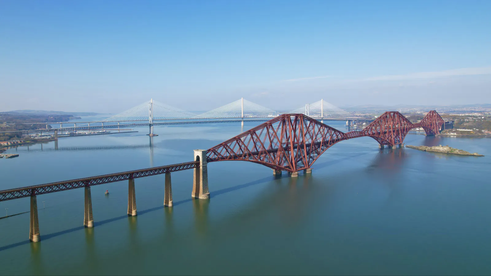
Forth Bridge: three cantilever towers across a firth
The railway crosses the Firth of Forth on a steel structure opened in 1890 between South Queensferry and North Queensferry. Historic Environment Scotland records three cantilever towers, two 521 m main spans and a 107 m suspended section in each; UNESCO gives the same span measurements. Fowler and Baker designed it after the 1879 Tay Bridge failure prompted the company to drop Thomas Bouch’s earlier scheme. One brick pier from that plan remains on Inchgarvie beneath the later bridge. The foundations were sunk in wrought-iron caissons 21 m wide.[5][6]
Giant’s Causeway: columns formed from lava in a river valley
The National Trust describes a sequence: basalt from eruptions buried an older chalk landscape, rivers then cut valleys, and a later lava flow ran into them. As that flow cooled it contracted and fractured; glaciers and the sea then wore away the covering rock. UNESCO counts about 40,000 columns and dates their formation to roughly 60 million years ago. DAERA says the reserve’s paths link the Causeway Head visitor centre with Hamilton’s Seat. Its account distinguishes a route along the cliff top from one midway up the cliffs, which gives views towards Port-na-Spaniagh. DAERA also notes that the Spanish ship Girona sank there in 1588.[7][8][9]
Good to know
A few clear answers before you explore.
Why does a phone on the Greenwich line not show zero degrees?
Satellite navigation uses a modern reference frame whose zero meridian is east of the historic telescope line. A 2015 geodesy study measures the separation at about 102 m; the Royal Museums Greenwich gives 102.5 m.[1][4]
Why is there a brick pier beneath the Forth Bridge?
It is a surviving pier from Thomas Bouch’s abandoned design. Historic Environment Scotland places it on Inchgarvie and links the change of plans to the 1879 Tay Bridge disaster.[5]
How did the Giant’s Causeway columns form?
The National Trust traces the columns to lava cooling and contracting into fractures; later erosion stripped away the covering rock and exposed them.[7]
The WorldStamped community
Every visit becomes part of a story.
- Members with public visits
- 0
- Places with public visits or memories
- 0
- Public memories
- 0
No public visits have been counted here yet. Add this destination to your own map and choose what you want to share.
Members are counted once. Counts include only eligible public activity from profiles that allow search discovery. Private and followers-only content is excluded.