🇳🇱Country
Waterworks with three different roles
At the Afsluitdijk, sluices carry excess freshwater from the IJsselmeer to the Wadden Sea. At the Oosterschelde Barrier, gates normally remain open so the tide can continue; in Kinderdijk, historic mills remain part of a landscape now managed mainly by pumps.
At a glance
A place worth remembering
A dike that separates water but keeps routes through it
The 32 km Afsluitdijk separates the freshwater IJsselmeer from the Wadden Sea. Lock complexes at Den Oever and Kornwerderzand let vessels pass and carry surplus water out; a fish passage near Den Oever addresses the barrier to fish moving between fresh and salt water.[1]
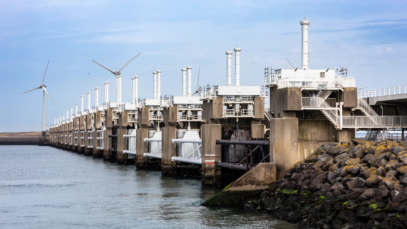
A tidal estuary behind a closable span
The 9 km Eastern Scheldt Barrier connects Schouwen-Duiveland and Noord-Beveland; 3 km can be closed by its 62 gates. The gates normally stay open, so tides keep ebbing and flowing and the water stays salty. Rijkswaterstaat says they are lowered for storm-surge protection when forecasts put water levels above 3 m NAP.[2]
Storage basins bridge drainage and pumping
At Kinderdijk, basins held excess water when high river levels prevented discharge through sluices. In 1738–1740 the area gained sixteen windmills tied to those basins; with the other mills, Kinderdijk now counts nineteen. Kinderdijk says the windmills still serve as backups to the modern water-management system.[3]
Good to know
A few clear answers before you explore.
What changed when the Vlieter gap was closed?
The last gap in the Afsluitdijk closed on 28 May 1932. The Zuiderzee was then called the IJsselmeer.[1]
When are the Eastern Scheldt Barrier gates lowered?
Rijkswaterstaat says the gates are lowered for storm-surge protection when forecasts put water above 3 m NAP (Normaal Amsterdams Peil, the Dutch height datum). Under normal conditions they remain open, allowing the tide to continue.[2]
Do Kinderdijk’s windmills still pump water?
Kinderdijk says the mills still serve as a reserve for the water-management system, though modern pumping stations have made their original drainage purpose redundant.[3]
The WorldStamped community
Every visit becomes part of a story.
- Members with public visits
- 0
- Places with public visits or memories
- 0
- Public memories
- 0
No public visits have been counted here yet. Add this destination to your own map and choose what you want to share.
Members are counted once. Counts include only eligible public activity from profiles that allow search discovery. Private and followers-only content is excluded.