🇰🇳Country
Brimstone Hill, two volcanoes and the vervets of Saint Kitts and Nevis
Saint Kitts and Nevis consists of two volcanic islands in the Caribbean, separated by a channel about 3 km wide called The Narrows. On Saint Kitts, Brimstone Hill Fortress stands on a lava dome on the flank of Mount Liamuiga, a volcano with a summit crater 244 metres deep. On Nevis, Nevis Peak rises to 985 metres in the middle of the island. A 2015 genome study traces the islands’ wild vervets to a small founding population from West Africa, with arrivals in the Caribbean beginning by the 17th century.
At a glance
A place worth remembering
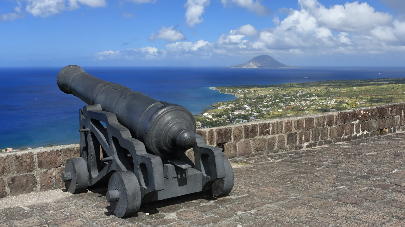
Brimstone Hill: a fortress on a lava dome
UNESCO describes a British-designed fortress built on a steep, twin-peaked volcanic hill rising 230 metres, using the labour of enslaved Africans. It records that a British cannon was installed there in 1690; the fortress grew over the following century and was abandoned by the British military in 1853. Main buildings stand on different levels in the hill’s upper third. Their walls combine dressed blocks with a rubble core; builders used local limestone at corners and around doors and gun openings, drawing much of the material from quarries lower on the slopes. The UWI Seismic Research Centre groups Brimstone Hill with lava domes associated with Mount Liamuiga’s flanks, and notes that cracks in the limestone at the foot of the hill smell strongly of sulphur, with sulphur crystals lining them in places.[1][2]
Mount Liamuiga and Nevis Peak: the two volcanoes
The UWI Seismic Research Centre gives Mount Liamuiga a height of 1,155 metres, with a summit crater about 900 metres wide and 244 metres deep. It dates a major eruption to about 1,600 years ago and calls reports of eruptions in 1692 and 1843 unsubstantiated, and records low-temperature fumaroles of up to 100 °C in the crater. The UWI profile says continuous seismic monitoring began in 1957 at Bayfords Farm, 8 km south-east of the crater, and describes a seven-station GPS network for measuring ground deformation. Across The Narrows, Nevis Peak rises to 985 metres in the middle of Nevis. The same centre reports no eruptions in historical time and gives approximate ages of 0.98 million years for the dome associated with the main cone and 0.10 million years for a smaller feature called the Intracrateral Dome. It also reports hot springs near Bath Estate and beside Cades Bay beach.[2][3]
Vervet monkeys: a West African population on both islands
Wild vervet monkeys live on Saint Kitts and Nevis, and also on Barbados. A 2015 Genome Research paper, which presented the reference genome of Chlorocebus aethiops sabaeus, traces the Caribbean populations to West African animals brought to the islands from the 17th century onward. Its authors compare one part of the genome, the MHC class I region, in samples from seven Saint Kitts locations (21 animals) and four in Ghana (11 animals), which they consider a possible source region. The six MHC class I haplotypes found among 51 vervets at US primate centres also appeared in 75% of the sampled Saint Kitts animals; the Ghana group showed greater diversity. The authors interpret that contrast as further evidence that the Saint Kitts population descended from a small founding group. Nevis animals were not included in their sample.[4]
Good to know
A few clear answers before you explore.
Is Brimstone Hill a volcano?
UNESCO calls it a steep, double-peaked volcanic hill rising 230 metres, and the UWI Seismic Research Centre groups it with lava domes associated with Mount Liamuiga’s flanks. The centre adds that cracks in the limestone at the foot of the hill smell strongly of sulphur; a 2002 survey by Simpson and Shepherd, which it cites, saw no steaming.[1][2]
What does UWI say about eruptions at Mount Liamuiga?
The UWI Seismic Research Centre dates a major eruption to about 1,600 years ago and calls reports from 1692 and 1843 unsubstantiated. It regards the volcano as potentially active. For Nevis Peak, the same centre reports no eruptions in historical time and dates the small Intracrateral Dome to about 0.10 million years ago.[2][3]
Where do the monkeys of Saint Kitts and Nevis come from?
A 2015 paper in Genome Research traces the Caribbean vervets to West African animals brought to the islands from the 17th century onward. Comparing MHC class I sequences from Saint Kitts and Ghana, the authors see evidence of a recent founder effect on Saint Kitts. Nevis animals were not included in their sample.[4]
The WorldStamped community
Every visit becomes part of a story.
- Members with public visits
- 0
- Places with public visits or memories
- 0
- Public memories
- 0
No public visits have been counted here yet. Add this destination to your own map and choose what you want to share.
Members are counted once. Counts include only eligible public activity from profiles that allow search discovery. Private and followers-only content is excluded.