🇳🇷Country
Nauru: clouds the island makes, pinnacles and soils of Topside, and an endemic reed-warbler
Nauru’s western shore hosted an ARM climate station that measured the island’s low-cloud effect; soil research reconstructs Topside before phosphate mining, and a 2006–07 survey records the endemic reed-warbler.
At a glance
- Island effect in the 2012 study abstract
- The abstract estimates an effect during about 11% of daylight hours and about 17% less downwelling shortwave radiation during it.[4]
- Phosphate removed during the twentieth century
- Morrison and Manner’s 2005 study estimates that about 100 million tonnes of phosphate have been taken from Nauru.[6]
- Nauru reed-warbler population estimate (2006–07)
- About 5,000 birds, estimated by Buden from fieldwork in 2006–07[7]
A place worth remembering
Denigomodu: a climate station and the clouds Nauru makes
The Atmospheric Radiation Measurement (ARM) programme, run by the U.S. Department of Energy, established its second Tropical Western Pacific site on Nauru. In a 1999 conference paper, Clements and co-authors locate the site at Denigomodu, close to the General Hospital on the island’s west side, 7 m above mean sea level. They describe an opening ceremony on 20 November 1998; ARM’s campaign page dates formal commissioning to 28 November. The site operated with the Nauru Department of Island Development and Industry. ARM’s account of the Nauru Island Effect Study says it ran from November 2001 through May 2003, separating the island’s influence on station measurements. Long and McFarlane later analysed five years of observations. Their abstract estimates that solar heating produces an island effect during about 11% of daylight hours. During the effect, downwelling shortwave radiation is about 17% lower; when clouds are also present, the frequency of cloud bases at 500–1,000 m is 15–20% higher. Averaged over daylight, low-cloud occurrence is about 2% higher and radiation about 2% lower; over 24 hours, each difference is about 1%. ARM dates the station’s shutdown to 30 August 2013.[1][2][5][3][4]
Topside: pinnacles, four soil associations and Buada Lagoon
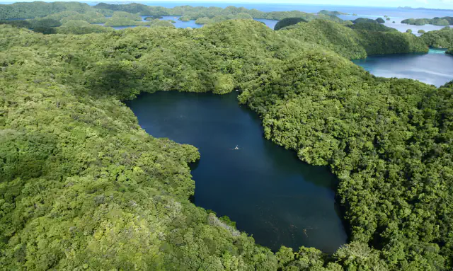
Buden’s 2008 survey describes Nauru as a raised atoll of 21 km². A narrow coastal belt rises over a steep scarp to the central plateau, which Morrison and Manner note is known locally as Topside. Their 2005 study reconstructs four broad soil associations across the reef-fringed coast, the plateau and scarp, and the low terrain around Buada. In their account, small remnants of three original associations remain; relatively deep soil profiles without substantial pinnacle influence have disappeared completely. Buden describes coral-limestone pinnacles 4–8 m high and notes a small settlement beside brackish Buada Lagoon in the island’s southwest.[7][6]
Birds: the endemic Nauru reed-warbler and noddy-catching
Donald Buden’s 2008 paper reviews 25 indigenous bird species. The abstract marks seven as confirmed or probable resident breeders; the discussion also includes former breeders in that group. Buden names two indigenous breeding land birds: the pigeon Ducula oceanica and Nauru’s endemic reed-warbler, Acrocephalus rehsei. After a six-hour stop on 24 July 1880, Otto Finsch noted the reed-warbler; his 1883 account described it as a new species. Based on his 2006–07 visits, Buden estimated about 5,000 reed-warblers on the island. He observed them in remnant plateau forest, gardens and regenerating scrub in mined areas. His field account also documents noddy-catching around the plateau interior. Buden reports fewer black noddies than formerly, noting continuing hunting and mining-related habitat loss.[7]
Good to know
A few clear answers before you explore.
How do the three Nauru settings fit together?
The ARM station stood on the western coast at Denigomodu. Morrison and Manner use Topside for the raised interior, while Buden notes a settlement beside the brackish lagoon at Buada in the southwestern plateau.[1][6][7]
Does Nauru have a UNESCO World Heritage property?
UNESCO’s page for Naoero records ratification of the World Heritage Convention on 22 July 2024 and lists no inscribed property and no sites on the Tentative List.[8]
Is the ARM station still operating?
No—the station stopped taking measurements on 30 August 2013. ARM’s closeout report says the remaining infrastructure and equipment went to Nauru’s Department of Commerce, Industry and Environment; the station page lists 15 instruments, all inactive.[5][2]
The WorldStamped community
Every visit becomes part of a story.
- Members with public visits
- 0
- Places with public visits or memories
- 0
- Public memories
- 0
No public visits have been counted here yet. Add this destination to your own map and choose what you want to share.
Members are counted once. Counts include only eligible public activity from profiles that allow search discovery. Private and followers-only content is excluded.