🇫🇲Country
Micronesia: basalt islets at Nan Madol, a town raised from reef coral at Lelu, and Chuuk Lagoon's wartime sites above and below water
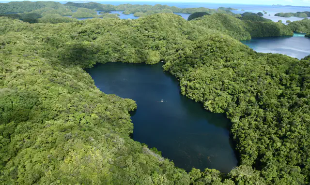
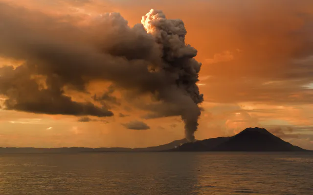
Nan Madol's 99 artificial islets on Pohnpei, the coral-built town of Lelu off Kosrae and the wartime sites of Chuuk Lagoon lie in three states of the Federated States of Micronesia, each known through a different kind of record: an ICOMOS evaluation, a museum blog post and a University of Guam survey. Each stands on its own; none summarises the country.
At a glance
A place worth remembering
Nan Madol, Pohnpei: 99 artificial islets of basalt and coral
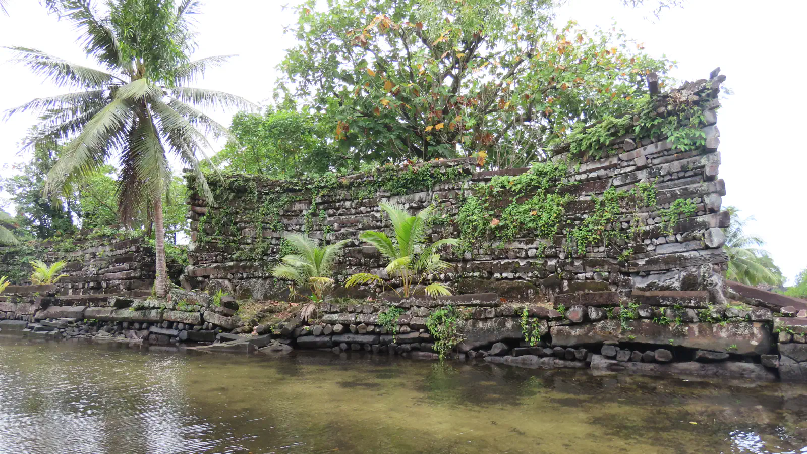
Nan Madol stands in Madolenihmw municipality, off the south-east coast of Pohnpei. ICOMOS's 2016 evaluation describes 99 artificial islets spread across a shallow reef platform beside the small island of Temwen and divided by navigable tidal canals. The islets were walled with basalt and coral boulders and filled with coral rubble from the reef and soil from Temwen. On top stand monumental walls, some of them 6–7 m high, built of prismatic basalt columns around tombs, residential domains and sites for sacred and ceremonial activities. The evaluation records an estimate that the island populations quarried, transported and laid 2,000 tons of volcanic rock every year for at least three to four centuries, without pulleys, levels, metal tools or wheels. Several methods date the site. McCoy and colleagues (Quaternary Research, 2016) dated coral from the tomb of the island's first chief by uranium-thorium (230Th/U) analysis and put the start of monument building at AD 1180–1200. ICOMOS cites a uranium-series date of about 1200 CE for Nandowas, an islet of ritual significance in the north-eastern half of the complex, and says that by the 1820s people no longer lived at Nan Madol.[1][2]
Lelu, Kosrae: a town built with reef coral
Lelu lies off Kosrae Island. ICOMOS treats it as the closest comparison for Nan Madol: about one-third the size, the seat of the Tokosra dynasty, and, in the evaluation's summary of the nomination, similar enough to suggest a common ancestral culture. The evaluation adds that the state intended to nominate Lelu as a second component once questions of ownership, protection and management were resolved. In a 2012 Australian Museum blog post, the coral biologist Zoe Richards places Lelu's development between AD 1250 and 1850 and, citing French and Russian accounts from the early 1800s, gives about 20 ha for the town. The post reports that reef coral was used widely: for the truncated-pyramid tombs of kings and high chiefs in the Insaru compound, and for paving, compound and canal walls, a seawall more than 3 m high and over 1 km long, and landfill that reclaimed over 180,000 m² of land. Coral from three tombs was sampled for uranium-thorium dating; the post gives no results. The coral details rest on that one post.[1][5]
Chuuk Lagoon: wartime sites on land as well as the wrecks
In February 1944, in Operation Hailstone, US aircraft attacked the Japanese ships in Chuuk Lagoon, and the sunken ships are the part of the story many people know. The US National Park Service says the atoll then endured nearly 7,000 tons of Allied bombs over 18 months and that the Chuukese lost over 1,000 people. A grant from the American Battlefield Protection Program, awarded to the University of Guam in August 2021, funded a project to document what else survives. A three-week survey in July 2023, led by William Jeffery, associate professor of archaeology and Micronesian studies, with the Chuuk Historic Preservation Office and the Tonoas mayor's office among the partners, worked on Tonoas, the Japanese wartime headquarters, then called Natsushima. The sites there include a hospital built in 1928, a 120 m long communications bunker and two anti-aircraft guns in the east of the island. On Etten, then Takeshima, much of the island is reclaimed land used as an airstrip, and its straight coastline is a wall built up with basalt rocks. The wreck of the Heian Maru was also surveyed in July 2023; the project plans to survey three more wrecks, record marine life on wrecks, and document bomb damage to traditional Indigenous sites on Tonoas. The Tonoas and Etten details come from the university's release alone. Ship counts differ between sources, so none is given here.[6][7]
Good to know
A few clear answers before you explore.
Where are these three places?
ICOMOS places Nan Madol in Madolenihmw municipality, Pohnpei State, off the south-east coast of Pohnpei Island, and Lelu off Kosrae Island. The University of Guam places Tonoas and Etten in Chuuk, and Tonoas inside the lagoon.[1][6]
How do researchers date Nan Madol?
With several methods, which give different dates for different islets. McCoy and colleagues dated coral from the first chief's tomb by uranium-thorium analysis and placed the start of monument building at AD 1180–1200. ICOMOS also cites a uranium-series date of about 1200 CE for Nandowas, radiocarbon dates from the Smithsonian Institution's 1963 excavations, and evidence of islets with some columnar basalt construction as early as 500–600 CE, and says Nan Madol served as the Saudeleur rulers' administrative and religious centre for 300–400 years.[2][1]
Which of these places are on UNESCO lists?
UNESCO's page for the country lists one inscribed property, Nan Madol: Ceremonial Centre of Eastern Micronesia (2016), and one Tentative List site, Yapese Disk Money Regional Sites (2004). Nan Madol has been on the List of World Heritage in Danger since 2016; UNESCO's text names overgrowth of vegetation, the effects of storm surge and some stonework collapse. The page does not list Lelu or Chuuk Lagoon.[4][3]
The WorldStamped community
Every visit becomes part of a story.
- Members with public visits
- 0
- Places with public visits or memories
- 0
- Public memories
- 0
No public visits have been counted here yet. Add this destination to your own map and choose what you want to share.
Members are counted once. Counts include only eligible public activity from profiles that allow search discovery. Private and followers-only content is excluded.