🇲🇲Country
Myanmar: Bagan’s brick temples, Inle Lake’s floating gardens and the Ayeyarwady dolphins
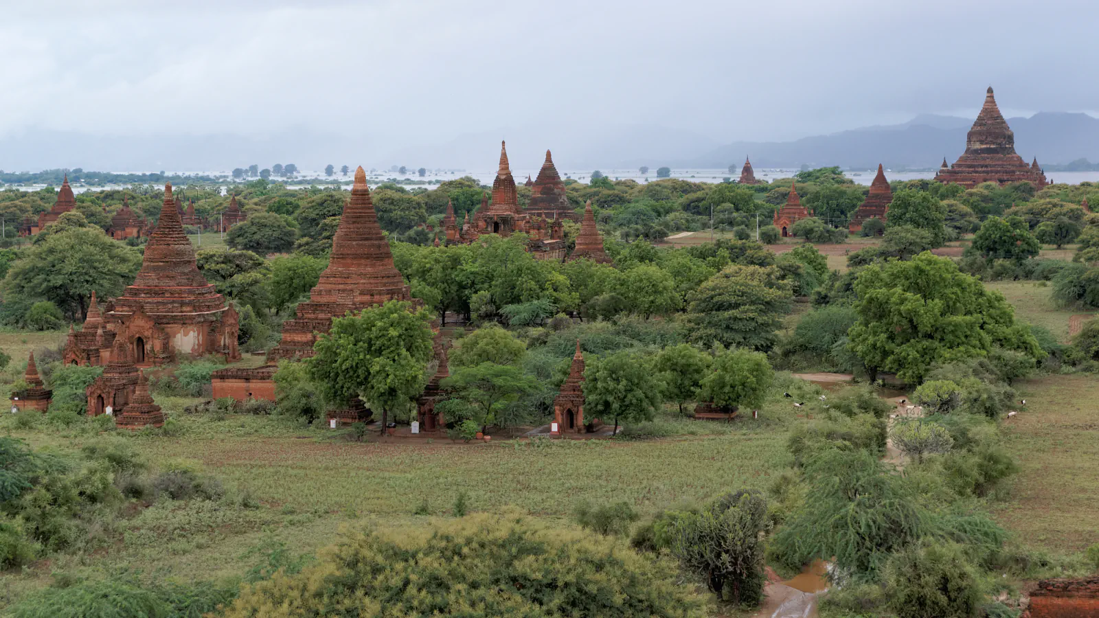
In Myanmar, also called Burma, something measurable has changed or is still at work at each of these places: a plain of brick temples at Bagan that was shaken by an earthquake on 24 August 2016, a lake in Southern Shan State whose open water has shrunk as floating gardens spread, and a stretch of the Ayeyarwady River where dolphins and cast-net fishers work together. They come from the central plain, Shan State and the river, and do not summarise the country.
At a glance
A place worth remembering
Bagan: brick temples, two earthquakes and the repairs between them
UNESCO describes Bagan as a sacred landscape on a bend of the Ayeyarwady River in the central plain, with 3,595 recorded monuments. The Tokyo National Research Institute for Cultural Properties (TNRICP) writes of more than 3,000 brick Buddhist stupas and small temples built mainly in the 11th to 13th centuries. A magnitude 6.8 earthquake struck central Myanmar on 24 August 2016, and by the end of October the Department of Archaeology, National Museum and Library had counted 389 damaged sites. TNRICP’s inspection team found that much of the damage was concentrated in parts rebuilt after the 1975 earthquake and at the joins between new repairs and old fabric, such as the upper part of a tower; cracks and deformation that age had already caused in vaults, walls and podiums are believed to have been made worse. A separate TNRICP survey of murals found that cracks in the brick and moving bricks had damaged the plaster, and that some materials used in earlier restorations were unsuitable for the murals and even harmful to them. UNESCO’s own text says authenticity has been impaired by inappropriate interventions in the 1970s and 1990s and by extensive earthquake damage.[1][2][3]
Inle Lake, Southern Shan State: gardens that moved the shoreline
Inle Lake lies in Southern Shan State at 884 m above sea level, in a valley between mountains of up to 1,500 m. UNESCO’s biosphere-reserve entry, which spells the name Inlay, says the lake formed more than 1.5 million years ago as a remnant of a much more extensive series of lakes created as water dissolved limestone. The Intha farm floating islands called ye-chan (Yechan in UNESCO’s text), and NASA says tomatoes make up about 90 percent of the production. Accounts of what the islands are made of differ: NASA describes water-hyacinth mats that, after 20 to 30 years, are about a metre thick and are sawn into strips and towed to stilt villages, while Sidle, Ziegler and Vogler describe blocks of organic-rich soil cut from swampy wetlands around the lake and staked with bamboo poles at the margin. Their 2007 paper compared maps surveyed in 1935–1937 with Landsat imagery from 2000 and found that the lake’s net open water fell from 69.10 to 46.69 km², a loss of 32.4 percent. About 93 percent of that loss they attribute to new floating gardens and to depleted gardens moved to the lake margins, mostly since the mid-1960s. NASA quotes the geographer Martin Michalon saying that the total lake area is relatively stable and that it is the open water that has shrunk.[4][5][6]
Ayeyarwady, Mingun to Kyaukmyaung: dolphins that herd fish to the nets
The Ayeyarwady between Mingun and Kyaukmyaung is the stretch covered by the Ayeyawady Dolphin Protected Area, and the fisheries scientist Mya Than Tun places the cooperative fishing of Irrawaddy dolphins (Orcaella brevirostris) and cast-net fishers there. Writing in 2007, she described how fishers call the dolphins by tapping the sides of their canoes, usually with a conical wooden pin; the dolphins answer with body movements and tail-fluke signals, herd fish towards the boats and show when to throw the net. The fishers told her they recognise individual dolphins, and some have names. The Wildlife Conservation Society (WCS) says the practice has been documented to give fishers a larger catch. The Department of Fisheries established the protected area in December 2005 with WCS support. Mya Than Tun reports that gill-net fishing and gold mining are prohibited inside it, and WCS lists electric fishing, gill nets, pollution, sedimentation and boat traffic among the threats the area was set up to reduce.[8][7]
Good to know
A few clear answers before you explore.
Where in Myanmar are these three places?
Bagan lies on a bend of the Ayeyarwady River in the central plain. Inle Lake is in Nyaung Shwe Township, Southern Shan State, at 884 m above sea level. The dolphin protected area follows the Ayeyarwady from Mingun in the south to Kyaukmyaung in the north.[1][4][7][8]
Is Inle Lake drying up?
Open water has shrunk: Sidle, Ziegler and Vogler measured a 32.4 percent loss between 1935 and 2000. NASA notes that research on this led to misleading stories that the lake was drying up, and quotes the geographer Martin Michalon that the total lake area is relatively stable while floating gardens have taken over open water.[6][5]
Has Bagan been damaged by earthquakes before 2016?
Yes. TNRICP notes that Bagan also suffered quake damage in 1975 and that many structures were restored or rebuilt afterwards. UNESCO says inappropriate interventions in the 1970s and 1990s impaired authenticity.[2][1]
The WorldStamped community
Every visit becomes part of a story.
- Members with public visits
- 0
- Places with public visits or memories
- 0
- Public memories
- 0
No public visits have been counted here yet. Add this destination to your own map and choose what you want to share.
Members are counted once. Counts include only eligible public activity from profiles that allow search discovery. Private and followers-only content is excluded.