🇱🇦Country
Laos in stone: jars, terraces and caves
Laos’s stone heritage ranges from jar sites linked to quarrying in Xiengkhuang to a mountain temple beside a spring at Vat Phou and deep karst caves at Hin Nam No.
At a glance
- Plain of Jars
- 2,107 known jars at 59 surveyed sites; 1,325 jars in the listed property’s 15 components (ICOMOS, 2019)[2]
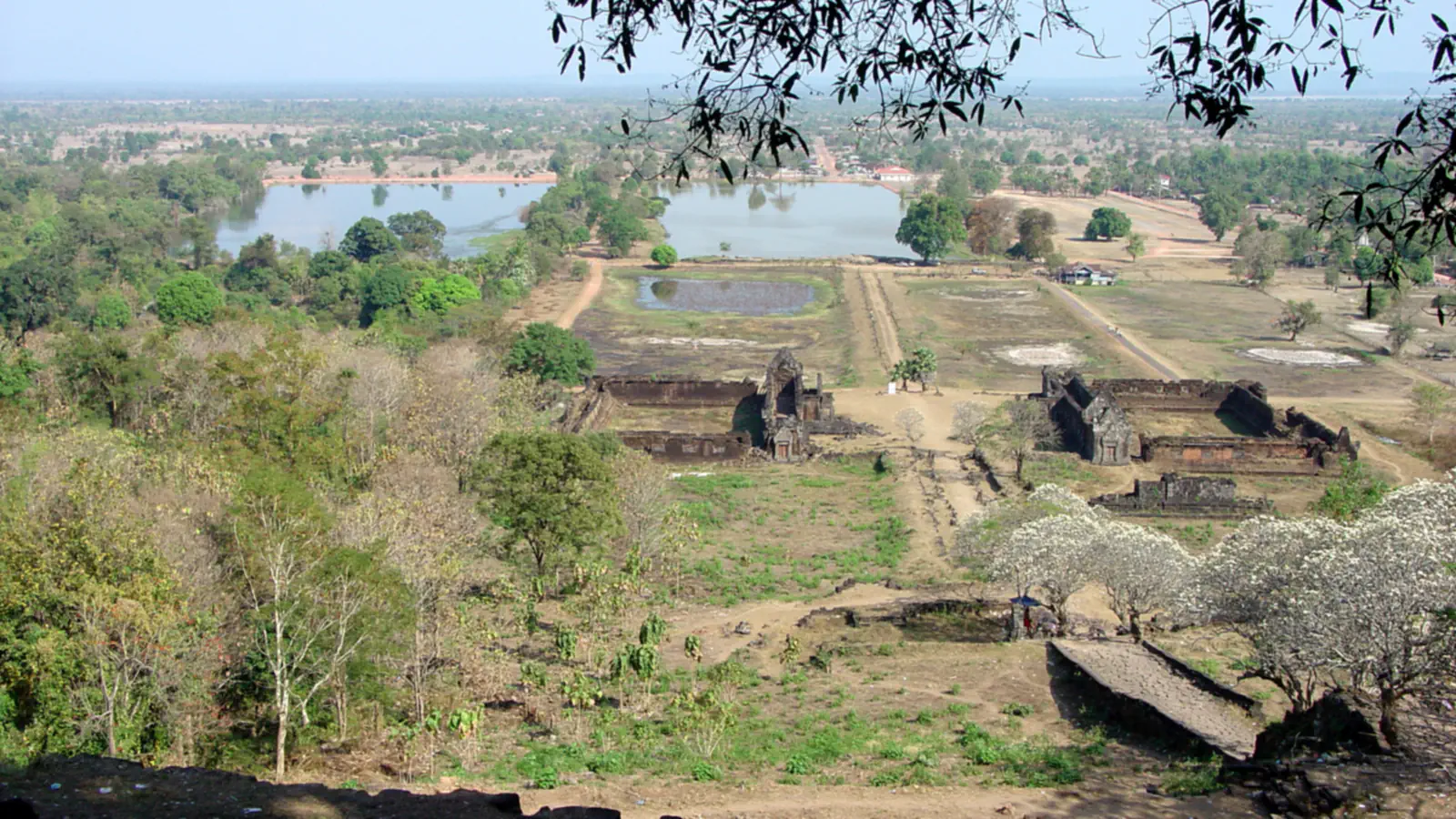
- Vat Phou
- A 1,400 m temple complex on six terraces within UNESCO’s broader Champasak landscape, which spans an axis of about 10 km (UNESCO; Laos nomination dossier)[3][4]
- Hin Nam No
- 94,121 hectares for the national park, as reported 17 July 2025 (KPL)[6]
A place worth remembering
Plain of Jars: what the counts cover
UNESCO links the jars scattered across Xiengkhuang’s plateau with Iron Age funerary practice and dates the associated sites to 500 BCE–500 CE. ICOMOS’s 2019 evaluation reports 2,107 known finished and unfinished jars across 59 surveyed sites and counts 1,325 jars within the UNESCO-listed property’s 15 components. At Site 21, associated with Site 1, ICOMOS notes evidence of every stage of quarrying preserved in place. A 900–1200 CE date in the evaluation applies to secondary burials excavated in 2016, not to jar-making.[1][2]
Vat Phou: temple and wider landscape
Vat Phou sits within the Champasak landscape between the Mekong and Phou Kao. UNESCO describes an approximately 10-kilometre axis linking river and mountain; the temple complex itself is 1,400 metres long on Phou Kao’s lower slope, arranged in six terraces. A spring emerges from rock beside the main sanctuary, just below 200 metres above sea level, according to the Laos nomination dossier.[3][4]
Hin Nam No: caves within a limestone karst
Good to know
A few clear answers before you explore.
What do the jar counts refer to?
The 2019 ICOMOS evaluation counts 2,107 known jars across 59 surveyed sites in Xiengkhuang; its 1,325 figure refers to jars recorded within the 15 components of the UNESCO property. The same report dates secondary burials excavated in 2016 to 900–1200 CE, not the jars.[1][2]
What does baray mean at Vat Phou?
A baray is a man-made water reservoir. The Laos nomination dossier locates one at the temple complex’s lower end, gives its approximate dimensions as 200 by 600 metres, and describes its 10th–11th-century construction date as probable.[4]
What is notable about the Hin Nam No landscape?
UNESCO describes a limestone karst plateau with deep caves and underground rivers. Its description also names the Xe Bang Fai cave. A KPL report dated 17 July 2025 gives 94,121 hectares for the national park.[5][6]
The WorldStamped community
Every visit becomes part of a story.
- Members with public visits
- 0
- Places with public visits or memories
- 0
- Public memories
- 0
No public visits have been counted here yet. Add this destination to your own map and choose what you want to share.
Members are counted once. Counts include only eligible public activity from profiles that allow search discovery. Private and followers-only content is excluded.