🇰🇼Country
Kuwait: a Hellenistic fortress on Failaka, a house of Bedouin weaving in the city and the tide-swept flats of Bubiyan
An island off the north-east coast where a Hellenistic fortress was built beside a well, a seafront house in Kuwait City given over to Bedouin weaving, and the tidal flats of Bubiyan Island in the north-west of the Gulf, where crab-plovers nest in burrows, are three quite different settings. Kuwait has much else beside these three.
At a glance
- Failaka
- Fortress well with a stone lining; its staircase rests on a clay layer level with the base of the ramparts[1]
- Sadu House
- Built in 1936; a home for weaving since 1980; al-Sadu is a warp-faced weave made on a ground loom[4][6]
- Bubiyan
- Tides of 3.5-4 m change the island's land area by about 40% a day, according to Kuwait's own 2017 submission[8]
A place worth remembering
Failaka: a Hellenistic fortress built beside a well
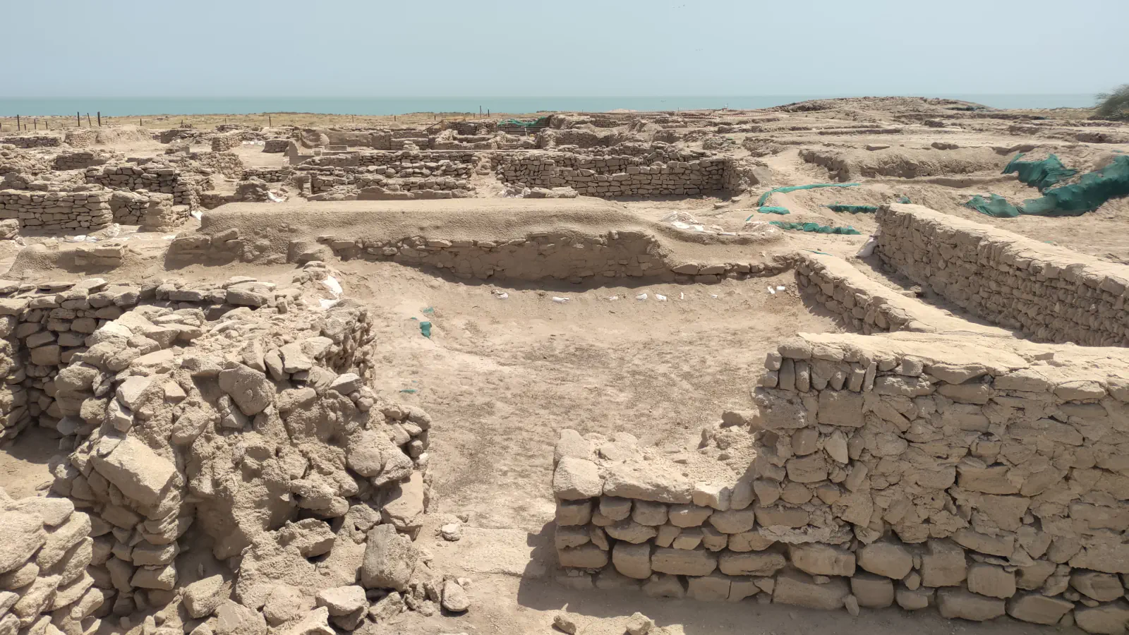
Failaka lies about 20 km off the north-east coast of Kuwait City and, according to Kuwait's submission to UNESCO's Tentative List, is up to 12 km long and 6 km wide. Despite the dry climate, people have lived there from the Middle Bronze Age to today, mainly thanks to its fresh water, writes archaeologist Mathilde Gelin (Arabian Humanities, 2024); the Nanterre research centre ARSCAN counts at least sixteen archaeological sites on the island since 1958. In the Hellenistic period it was called Ikaros, a name that, according to Arrian, Alexander the Great gave it. The fortress at Tell Sa'id on the south-west coast (Tell Sae'ed in Kuwait's submission), dated by earlier Danish and French missions to the very end of the 4th or the early 3rd century BC, stood until the 1st century BC; Kuwait's submission gives it as roughly 60 m on each side with a tower at every corner. A Greek-language dedication known as the Sotélès inscription names Sotélès the Athenian and his soldiers, and he is regarded as the probable founder. The soldiers' fresh water came from one, perhaps two, wells. The French-Kuwaiti mission, which studied the site from 2011 to 2018, found that the first well has a stone lining never reported before and that its staircase rests on a thick layer of fine, clayey earth lying exactly at the level of the base of the ramparts. Gelin explains that this layer steadied a well dug in loose sand and kept damp and salt away from nearby buildings. A second well turned up beside it in 2018, and the groundwater reaching the well today is partly salty.[1][2][3]
Sadu House: a seafront house that became a home for Bedouin weaving
Sadu House stands on Arabian Gulf Street next to the National Museum of Kuwait, in Kuwait City. According to the Al Sadu Society, Youssef Al Marzouk, head of an affluent family, built it in 1936 as a house overlooking the seafront, with four open courtyards and Indian decorative touches such as wooden doors brought from Karachi and iron window fittings; the builder Rashid Al Benai supervised the work, and the walls are stone reinforced with concrete. In 1938 it passed to Shereen Behbehani, who added a floor; the State purchased it in the 1970s, in 1980 it became a home for weavings and textiles, and it was restored in 2006. The craft it shelters is al-Sadu. UNESCO's description says the word means weaving done in a horizontal style, a warp-faced plain weave made on a ground loom from natural fibres found in the weavers' surroundings. The patterns are geometric designs repeated in rhythm and symmetry, reflecting the desert, with bright reds and oranges as accents, and UNESCO notes that the finer the yarn, the more delicate the pattern. The main bearers are older Bedouin women who are master weavers; skills are passed on mostly within households, with associations and educational bodies adding classes and workshops.[4][5][6]
Bubiyan: tidal flats whose land area swings with the tide
Bubiyan Island (Boubyan in Kuwait's submission), in the north-west corner of the Gulf, contains the Mubarak Al-Kabeer Reserve, designated a Ramsar site on 5 May 2015 and covering 50,948 ha; Ramsar describes it as flat and low, with shallow salt marshes and small lagoons. Kuwait's 2017 Tentative List submission, whose text is the responsibility of the State Party, adds figures: the island's higher ground rises only 1-4 m above mean sea level, tides of 3.5 to 4 m flood the low coast and inland salt flats, and the land area is said to change by about 40% a day, from 863 km² at low tide to about 520 km² at high tide. The same text mentions oyster reefs that it calls biogeographically rare. A peer-reviewed study of the Bubiyan Islands in 2012-2014 (Bom and Al-Nasrallah, Wader Study, 2015) found up to 1,750 burrows of the crab-plover in a single year. The birds breed in colonies inside burrows they excavate themselves, between April and July, and the parents brought crabs (75% of observed prey items) and mudskippers (25%) to their young. The authors estimate that at least 3-5% of the world population breeds on the islands.[7][8][9]
Good to know
A few clear answers before you explore.
Is Failaka a World Heritage Site?
No. Kuwait's Tentative List submission of 27 February 2013 covers the Sa'ad and Sae'ed area of Failaka under cultural criterion (iii); it is not an inscription. The Nanterre research centre says Kuwait is preparing a nomination titled “Failaka Island: A Palimpsest of Human Civilizations”.[3][2]
How is Failaka linked to Bahrain?
Kuwait's submission says that in the Bronze Age Failaka was part of Dilmun, the civilisation centred on Bahrain, from the end of the 3rd to the middle of the 1st millennium BC. Gelin adds that the two islands lie about 400 km apart and that much similar pottery has been found at Ikaros and in Hellenistic levels of Bahrain, at its necropolises and at Qal'at, which points to shared trade networks.[3][1]
How firm are the Bubiyan figures?
The tide and land-area figures come from Kuwait's own Tentative List text, which UNESCO publishes without endorsing, so they are single-source. The crab-plover numbers are from a peer-reviewed study of 2012-2014 and count burrows, not birds; this page draws on its abstract only.[8][9]
The WorldStamped community
Every visit becomes part of a story.
- Members with public visits
- 0
- Places with public visits or memories
- 0
- Public memories
- 0
No public visits have been counted here yet. Add this destination to your own map and choose what you want to share.
Members are counted once. Counts include only eligible public activity from profiles that allow search discovery. Private and followers-only content is excluded.