🇪🇹Country
Northern Ethiopia: the rock of Lalibela, the salt dome of Dallol and the ibex of Simien
The churches of Lalibela are cut from basaltic scoria that rainwater keeps reaching, Dallol is a salt dome on a plain 120 m below sea level in northern Afar, and the walia ibex of the Simien Mountains was counted in 2015, in 2019–2021 and in 2024. All three places lie in northern Ethiopia, so this page does not stand for the whole country.
At a glance
A place worth remembering
Lalibela: the stone, and the water that reaches it
UNESCO describes eleven medieval monolithic churches carved out of rock in a mountainous region some 645 km from Addis Ababa: five in a group north of the river Jordan, five south of it, and Biete Ghiorgis, which stands apart but is linked to the others by trenches. Geologists have also examined the stone itself. Older literature often calls it weathered basic tuff; a 2011 study of samples from seven of the churches (Renzulli and colleagues) classes it instead as a basaltic scoria deposit, hydrothermally altered and partly lateritised, and suggests that its pyroclastic origin may have strongly enhanced selective weathering. Water is the recurring problem. UNESCO says the drainage ditches were filled with earth for several centuries before being cleared in the 20th century and have been disrupted by seismic activity, with severe water damage as a result, and that temporary light-weight shelters have been installed over some churches; they offer protection but affect visual integrity. A 2022 moisture study at two of the churches found the walls more saturated at depth than at the surface in the wet season, and ties the strong wetting during rainy periods to the lack of impermeable roofs and foundations at rock-cut sites. Expertise France lists a feasibility study, running from September 2019 to June 2021, that included monitoring the stability of the existing shelters and studying possible alternative protection structures.[1][2][3][4]
Dallol: a salt dome 120 m below sea level
Dallol is a dome 40 m high on the Danakil Depression, which a 2020 paper in Frontiers in Earth Science describes as a north–south salt plain lying 120 m below sea level in northern Afar. The same paper reports three field campaigns (January 2016, 2017 and 2019) and proposes a sequence: at least one deep basalt intrusion, later than 6,000 years ago, pushed up lake deposits of that age on the west side of the dome; the magma’s contact with buried salt produced what the authors call halo-volcanic activity, with likely several melted-salt effusion events. A dyke intrusion in October–November 2004 reactivated the hydrothermal system, opening new fractures on the top of the dome and shifting activity northward. The geoheritage entry of the IUGS International Commission on Geoheritage (by Asfawossen Asrat) adds that the depression also holds the Ert’ale volcano with an active lava lake and several salt lakes, and that its salt has been mined by traditional miners for centuries and still is.[5][6]
Simien Mountains: counting the walia ibex
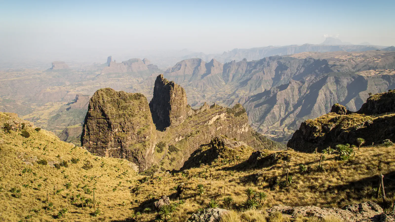
UNESCO lists the park as Simien National Park; some of its cliffs reach 1,500 m in height and the northern cliff wall extends for some 35 km. The cliff areas are the main habitat of the walia ibex (Capra walie), a wild mountain goat that UNESCO says is endemic to the Simien Mountains. A 2025 paper in Oryx by Scholte and colleagues reports census counts across the species’ range of about 100 km²: 865 animals in 2015, 650 in 2019–2021 and 306 in 2024. More than 70% of those interviewed, among them community representatives and park personnel, attributed the drop to poaching; the authors see instability linked to Covid-19 and the 2021–2022 war as the fundamental cause and recommend raising the species’ IUCN Red List category to Critically Endangered. UNESCO adds that 80% of the park was under human use of one form or another at the time of inscription, and says cultivation and grazing have severely affected critical habitats of the walia ibex.[7][8]
Good to know
A few clear answers before you explore.
Why do some of the Lalibela churches have shelters built over them?
UNESCO reports that the drainage ditches around the churches were filled with earth for several centuries, cleared in the 20th century and since disrupted by seismic activity, with severe water damage as a result, and that temporary light-weight shelters have been installed over some churches; it says they offer protection but affect visual integrity. A 2022 moisture study at two churches ties strong wetting in rainy periods to the lack of impermeable roofs and foundations at rock-cut sites. Expertise France lists a feasibility study (2019–2021) that included monitoring the stability of the existing shelters and studying alternative protection structures. These sources do not say which shelters stand today.[1][3][4]
How did the Dallol dome form?
A 2020 paper based on field campaigns in 2016, 2017 and 2019 says its results suggest that the recorded history of the dome began when at least one deep basalt intrusion, later than 6,000 years ago, pushed up lake deposits of that age on its west side. The magma’s interaction with buried salt then produced halo-volcanic activity, with likely several melted-salt effusion events, and a dyke intrusion in October–November 2004 reactivated the hydrothermal system and moved it northward. This is the authors’ model of the dome’s evolution.[5]
How many walia ibex are counted in the Simien Mountains?
A 2025 paper in Oryx reports census counts across the species’ range of about 100 km²: 865 in 2015, 650 in 2019–2021 and 306 in 2024. More than 70% of those interviewed, among them community representatives and park personnel, named poaching as the cause of the fall, and the authors recommend raising the species’ IUCN Red List category to Critically Endangered. The page does not include any count after 2024.[8]
The WorldStamped community
Every visit becomes part of a story.
- Members with public visits
- 0
- Places with public visits or memories
- 0
- Public memories
- 0
No public visits have been counted here yet. Add this destination to your own map and choose what you want to share.
Members are counted once. Counts include only eligible public activity from profiles that allow search discovery. Private and followers-only content is excluded.