City
Djibouti City: a checkerboard town, Place Ménélik and the 1900 station
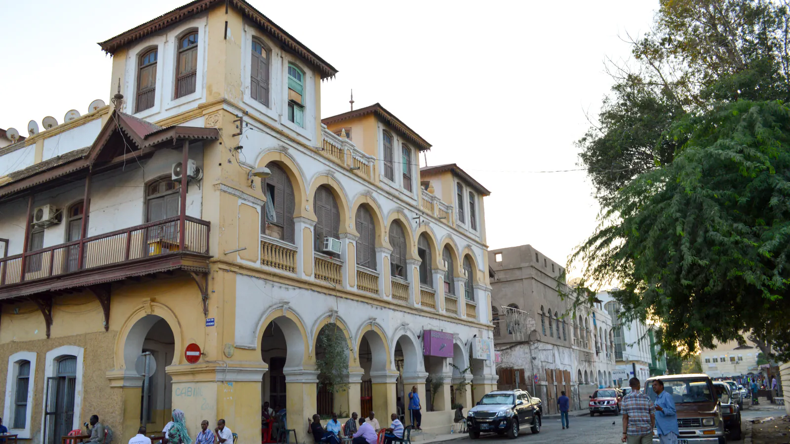
Djibouti’s nomination text for UNESCO’s tentative list describes a town that took shape on a marshy peninsula from 1890: first trading houses in 1891, then a checkerboard of streets on the Plateau de Djibouti, and the railway station on the Plateau du Marabout. Three places show how it was built: the grid with its thick madrépore walls (the text calls madrépore a relatively friable limestone), Place Ménélik with buildings that carry Yemeni and Indian influences, and the station inaugurated in 1900.
At a glance
A place worth remembering
The Plateau de Djibouti: a checkerboard of madrépore walls
The nomination text says the first trading establishments went up in 1891 on the north coast of the Plateau de Djibouti, on a marshy site. From them the town spread across the plateau on a cadastral plan of checkerboard blocks, which the text identifies with today’s historic centre; buildings are carefully aligned along streets and squares. To explain its building methods, the text points to walls of madrépore, which it calls a relatively friable limestone that withstands the local geomorphological and climatic conditions: very thick load-bearing walls, with facades roughly masoned in lime mortar. In another passage, on an early trading house, the same text calls madrépore a black volcanic stone. An order numbered 2005-0194 set a study perimeter around the old centre: Boulevard du Maréchal Foch to the north, Boulevard de Gaulle to the east, the railway line, Avenue Georges Pompidou and Boulevard Bonhoure to the west, and Rue Abdillahi Doualeh Waiss, Place Harbi and Avenue Cheik Houmed to the south.[1][3]
Place Ménélik: Yemeni masons, merchant houses and Indian craft
Place Ménélik, now called Place du 27 Juin, is what the nomination text calls “the heart of the European town”, with the Mairie (town hall) standing on the axis of the square. The text says the Mairie shows Yemeni architectural influence, which it explains by the recruitment of Yemeni masons and the strong presence of Yemeni merchants in the early twentieth century. These merchants had their own multi-storey houses built, with a ground floor that opened onto covered galleries and became shops and warehouses. The Maison indienne (“Indian house”), facing the square, reflects the arrival of Indian and Pakistani craftsmen at the same time: the text points to its turrets and balconies and calls it one of the last traces of that influence in the centre.[1]
The Marabout plateau: the station and the road between plateaus
According to the nomination text, the Plateau du Marabout, where the station stands, became the new economic pole, the Plateau du Serpent a residential district, and the town extended towards both in the early twentieth century. The Compagnie Impériale des Chemins de Fer Éthiopiens was created in 1896 and the station was inaugurated in 1900. The building has two end pavilions and a central building; the text says its metal structure was produced specially for it by the Eiffel workshops and that small vaults (voûtains) form the outer gallery around it, and it adds that the building marks the beginning of the railway line from Djibouti to Ethiopia. The city prefecture’s history page says the town grew on four plateaus, the fourth being the Héron islet north of the Marabout, and that the Boulevard de la République, 800 m long and 20 m wide and raised by 2 m against floods, joined the main plateaus.[1][2]
Good to know
A few clear answers before you explore.
What is Place Ménélik called today?
Place du 27 Juin. The nomination text calls it “the heart of the European town”, with the Mairie (town hall) on the axis of the square.[1]
Why does the Mairie show Yemeni influence?
The nomination text explains it by the recruitment of Yemeni masons and the strong presence of Yemeni merchants in the early twentieth century, who also built multi-storey houses with covered ground-floor galleries.[1]
What is notable about the station building?
It was inaugurated in 1900 and has two end pavilions and a central building. The nomination text says its metal structure was produced specially for it by the Eiffel workshops, with small vaults (voûtains) forming the outer gallery around it.[1]
The WorldStamped community
Every visit becomes part of a story.
- Members with public visits
- 0
- Places with public visits or memories
- 0
- Public memories
- 0
No public visits have been counted here yet. Add this destination to your own map and choose what you want to share.
Members are counted once. Counts include only eligible public activity from profiles that allow search discovery. Private and followers-only content is excluded.