🇨🇼Country
Curaçao’s painted Willemstad, its last-interglacial reef and the northwest bokas
Willemstad’s colours have a date: UNESCO traces the local tradition to 1817. Elsewhere on the island, stepped limestone terraces record old sea levels, among them a reef from the last interglacial in the Hato unit, and on the northwest coast narrow inlets called bokas cut through those terraces inside a Ramsar site.
At a glance
A place worth remembering
Willemstad: Punda, Otrobanda and a colour tradition from 1817
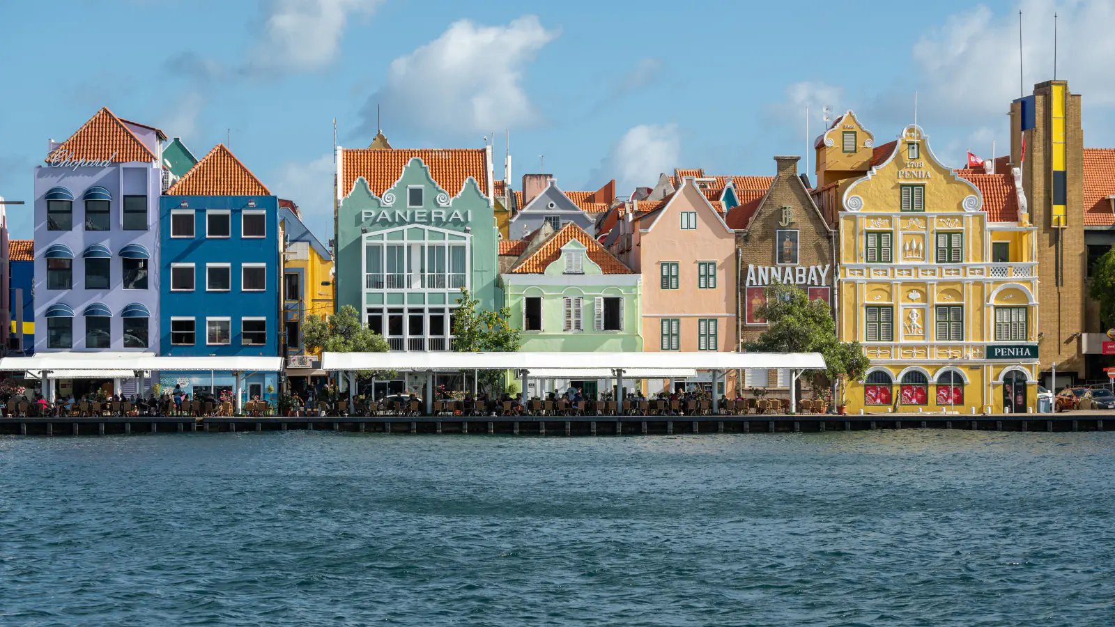
The property UNESCO lists as ‘Historic Area of Willemstad, Inner City and Harbour, Curaçao’ grew from Fort Amsterdam, begun in 1634 on the eastern bank of Sint Anna Bay. UNESCO’s description says Punda was built in the 17th century beside the fort and had a defence system of walls and ramparts, while Pietermaai, Otrobanda and Scharloo date from the 18th century, and Water Fort and Rif Fort, also part of the property, from the late 1820s. In Otrobanda, which ramparts did not confine, houses stood on spacious lots and resembled plantation houses surrounded by galleries. UNESCO calls the colours a local tradition dating from 1817, when the earlier white lime finish on exteriors was prohibited, apparently to protect eyesight from the glare. Red, blue, yellow ochre and shades of green predominate.[1]
Hato and the stepped terraces: a reef from the last interglacial
Kambesis and colleagues (2016) describe Pleistocene reef terraces on the northwest coast at four elevation ranges, from 5–10 metres up to 90–175 metres above sea level, with caves formed by dissolution of the limestone. Muhs and colleagues (2012) dated corals of the Hato (upper) unit of the Lower Terrace by uranium series and conclude that the reef formed in the last interglacial, when a high sea stand lasted at least 8,000 years, from about 126,000 to 118,000 years ago. From the elevation and age of that reef they derive a low uplift rate for Curaçao, 0.026 to 0.054 metres per thousand years, and they date corals of the older Cortalein unit to about 200,000 years. According to Kambesis and colleagues, the Hato Caves, a series of show caves near the airport, lie in the Higher Terrace, a different unit from the Lower Terrace that holds the Hato unit.[3][2]
The northwest coast: bokas, turtles and a Ramsar site
In field surveys in March 2011 and 2012, Kambesis and colleagues mapped 17 bokas, from Nordpunt at the extreme northwest of the island to Boka Grande in Christoffel National Park. They describe a typical boka as about 10 metres deep and 30 to 40 metres wide, running inland several hundred metres, and say the large ones developed where inland streams cut through the lowest limestone terrace, with waves entering their lower parts. The Ramsar Site Northwest Curaçao (no. 2119, 2,441 hectares, designated 5 February 2013) covers about 20 kilometres of this rocky north coast and parts of the Shete Boka and Christoffel parks. Its information sheet names the leatherback (Dermochelys coriacea) and hawksbill (Eretmochelys imbricata) among the threatened sea turtles that use its beaches and inland bays for nesting and foraging, records a breeding colony of more than 500 least terns, and reports a fringing coral reef with more than 50 per cent coral cover, including Acropora palmata and Acropora cervicornis.[3][4]
Good to know
A few clear answers before you explore.
Why are the buildings of Willemstad painted in so many colours?
UNESCO describes the colours as a local tradition dating from 1817, when the earlier white lime finish on exteriors was prohibited, apparently to protect eyesight from the glare. Red, blue, yellow ochre and shades of green predominate.[1]
How old is the Hato reef unit?
Uranium-series ages of its corals show that it formed in the last interglacial, during a high sea stand that lasted at least 8,000 years, from about 126,000 to 118,000 years ago (Muhs et al., 2012). The Hato Caves are not in this unit: Kambesis and colleagues place them in the Higher Terrace.[2][3]
What is a boka?
Kambesis and colleagues use the local name for large rectilinear coastal inlets that run hundreds of metres inland from the northwest coast, are tens of metres wide and have steep vertical walls more than ten metres high in places. They say the large ones developed where inland streams cut through the lowest limestone terrace.[3]
The WorldStamped community
Every visit becomes part of a story.
- Members with public visits
- 0
- Places with public visits or memories
- 0
- Public memories
- 0
No public visits have been counted here yet. Add this destination to your own map and choose what you want to share.
Members are counted once. Counts include only eligible public activity from profiles that allow search discovery. Private and followers-only content is excluded.