🇨🇺Country
Cuba from Viñales to Santiago Bay: tobacco, sugar and a terraced fortress
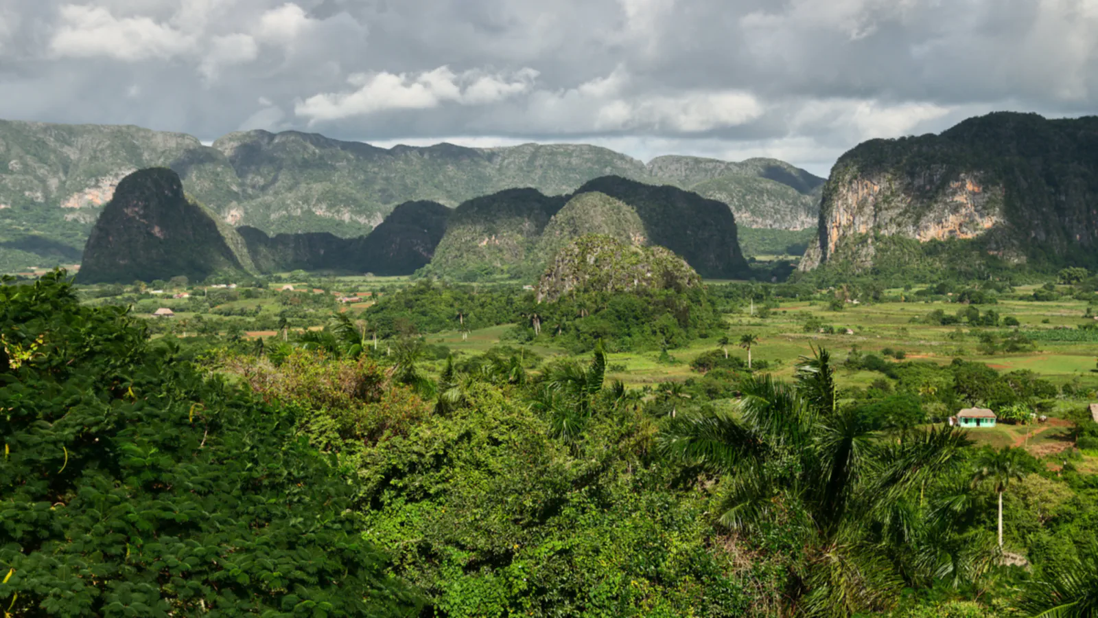
In western and south-eastern Cuba, three places show how agriculture and coastal defence shaped the landscape. Tobacco fields in Viñales sit among limestone mogotes; Valle de los Ingenios preserves traces of the sugar industry and enslaved labour; and San Pedro de la Roca commands the seaward approach to Santiago de Cuba Bay.
At a glance
A place worth remembering
Viñales Valley: limestone towers and animal traction
UNESCO locates the property in Sierra de los Órganos toward Cuba’s western tip; limestone mogotes reach up to 300 m above the karst plain. UNESCO dates settlement of the valley to the early 19th century, while ICOMOS places the village’s founding in 1875 as tobacco cultivation expanded. UNESCO’s account says tobacco farmers in Viñales still use animal traction. It links that practice to crop quality: mechanised cultivation and harvesting, it says, would reduce the quality of the tobacco leaf. UNESCO gives the property’s area as 132 km². The 1999 ICOMOS evaluation reports that 92% of the area proposed for inscription was in private hands: up to 30% with scattered individual farmers and the rest with the National Association of Small Farmers.[1][2]
Valle de los Ingenios: sugar mills and enslaved labour
The listing includes San Luis, Santa Rosa and Meyer, a connected trio about 12 km northeast of Trinidad; together they cover 225 km². UNESCO’s account gives two measures of the valley’s sugar economy: over 11,000 enslaved workers in the mills in 1827, and more than 50 mills at work when the industry peaked in the 19th century. The property takes in the remains of 75 former sugar mills along with plantation houses, barracks and further structures tied to sugar production. UNESCO notes that Cuba’s long-running sugar-industry decline accelerated in the 1990s.[3]
San Pedro de la Roca: a fortress built in terraces
San Pedro de la Roca stands on El Morro’s rocky headland, facing Santiago de Cuba Bay from the island’s south-eastern coast. UNESCO dates its harbour-defence role to 1638 and attributes its design to Italian engineer Juan Bautista (Giovanni Battista) Antonelli. UNESCO describes the fortress as climbing the cliffs in terraces linked by stairways: a gun platform at the lowest level, close to the high-water mark, and the Santísima Trinidad Platform, built in the 1660s, which tops the main castle. ICOMOS says an English assault destroyed the fortress in 1662; builders reconstructed and expanded it in 1663–69. Earthquakes in 1675, 1678 and 1679 weakened the structure; consolidation and reconstruction followed in 1693–95. UNESCO adds that the North and South Bastions date from a mid-18th-century reconstruction, and that the fortress was restored in the 1960s.[4][5]
Good to know
A few clear answers before you explore.
Why is animal traction still used in Viñales Valley?
UNESCO links the continued use of animal traction to tobacco quality: it says mechanised fieldwork and harvesting would lower the quality of the leaf. ICOMOS separately reports experiments with a similar result.[1][2]
How many enslaved people worked in the mills in 1827?
UNESCO records more than 11,000 enslaved people working in the mills that year.[3]
How did earthquakes affect San Pedro de la Roca?
ICOMOS records earthquakes in 1675, 1678 and 1679 that weakened it, reconstruction and consolidation in 1693–95, and damage in 1757 and, more severely, in 1766, followed by another restoration that took in newer developments in military architecture. UNESCO describes repeated restoration and strengthening after earthquakes and attacks.[4][5]
The WorldStamped community
Every visit becomes part of a story.
- Members with public visits
- 0
- Places with public visits or memories
- 0
- Public memories
- 0
No public visits have been counted here yet. Add this destination to your own map and choose what you want to share.
Members are counted once. Counts include only eligible public activity from profiles that allow search discovery. Private and followers-only content is excluded.