🇧🇦Country
Bosnia and Herzegovina: a city named for its bridge keepers, a bridge built for a flood river and waterfalls made of tufa
Mostar on the Neretva in the Herzegovina-Neretva Canton, the bridge over the Drina at Višegrad in the east, in Republika Srpska, and the Una National Park around Bihać in the far west cover three parts of Bosnia and Herzegovina. Mostar takes its name from the people who kept its bridge, the Višegrad bridge stands on wooden-raft foundations in a river that floods, and the Una builds its own waterfalls out of tufa. Many other towns, valleys and mountains are left out.
At a glance
- Martin Brod falls
- One complex 800 m long, 54 m total drop[8]
A place worth remembering
Mostar: a name that comes from the bridge
Mostar lies in the Herzegovina-Neretva Canton, in the valley of the Neretva between Hum Hill and the foot of Mount Velež. UNESCO says the name Mostar was first mentioned in 1474 and derives from mostari, the bridge keepers. ICOMOS, in its evaluation for UNESCO, ties the name to a wooden bridge that served the market town on the left bank, and notes that the town was fortified between 1520 and 1566 and that the bridge was rebuilt in stone. UNESCO credits the stone bridge, Stari Most, to mimar Hajruddin, working from a design by his master Sinan. ICOMOS records that between 1992 and 1995 the town was badly damaged and the Old Bridge destroyed; the bridge was rebuilt in 2004. According to UNESCO, the reconstruction followed the bridge’s pre-war appearance and the remaining original material is displayed in a museum. Water shaped the town too: a stream entering the Neretva on its right bank fed small canals used for irrigation and for driving the wheels of water mills.[1][2]
Višegrad: a bridge built to stand in the Drina
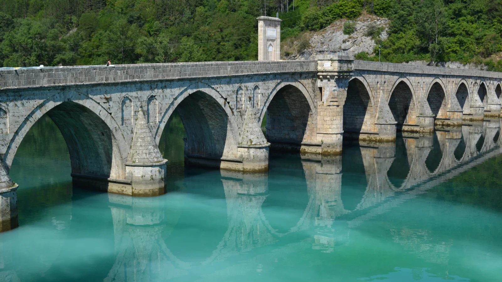
The Mehmed Paša Sokolović Bridge crosses the Drina in the east of Bosnia and Herzegovina, in Republika Srpska. It was built between 1571 and 1577 by the court architect Sinan, is 179.5 metres long and has 11 masonry arches with spans of about 11 to 15 metres. ICOMOS describes the foundations as wooden rafts reinforced with wooden piles and stone blocks, and the masonry as dressed travertine from local quarries, bound with material enriched with clay to improve its hydraulic properties. The Drina is a mountain river prone to flooding, and UNESCO records that an exceptional flood in 1896 destroyed the bridge’s parapets. More recently, ICOMOS names two power stations that changed the river’s flow: Bajina Bašta downstream, built in 1966, and Višegrad, about 2.5 km upstream, built in 1989. UNESCO says that the two stations, one in Bosnia and one in Serbia, affect water levels and threaten the foundations, and that Serbia’s Ministry of Mines and Energy wrote on 27 June 2007 in support of a bi-national working group to analyse the effect of power generation on the river.[3][4]
Una: a river that builds its own waterfalls
The Una National Park lies around Bihać in the far west of Bosnia and Herzegovina, on the border with Croatia, and covers 19,800 hectares. It was established in 2008, and the Federation of Bosnia and Herzegovina founded the public enterprise that runs it. The park describes the Una as a cascading river along almost its whole length. Barriers of tufa create its waterfalls, river islands and cascades, while the larger falls are tied to tectonic movements. At Štrbački buk the park gives a height of 24.5 metres and adds that mills once lined the banks and recalled the pile dwellings of the Iapodes, a prehistoric people who lived here in the last thousand years BC. At Martin Brod, where the Unac joins the Una, the park measures one waterfall complex at 800 metres in length, with a total drop of 54 metres.[5][6][9][7][8]
Good to know
A few clear answers before you explore.
Where does the name Mostar come from?
From mostari, the bridge keepers. UNESCO says the name is first mentioned in 1474, and ICOMOS links it to a wooden bridge that served the market town on the left bank of the Neretva.[1][2]
How was the Višegrad bridge made to cope with the Drina?
According to ICOMOS, its foundations are wooden rafts reinforced with piles and stone blocks, and its masonry is local travertine bound with clay-enriched material that improves hydraulic properties. The river still matters: UNESCO says two power stations affect water levels and threaten the foundations.[3][4]
What forms the waterfalls on the Una?
Barriers of tufa, according to the park, which says they create the river’s waterfalls, river islands and cascades. The larger falls, such as Štrbački buk at 24.5 metres, are tied to tectonic movements and tufa deposits.[8][7]
The WorldStamped community
Every visit becomes part of a story.
- Members with public visits
- 0
- Places with public visits or memories
- 0
- Public memories
- 0
No public visits have been counted here yet. Add this destination to your own map and choose what you want to share.
Members are counted once. Counts include only eligible public activity from profiles that allow search discovery. Private and followers-only content is excluded.