🇷🇸Country
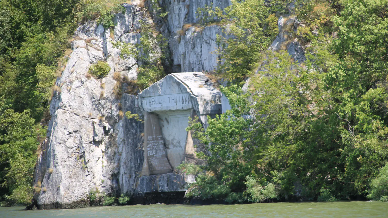
Serbia: Trajan’s Tablet and the road fragment beneath it
At Đerdap, a 1969 heritage report describes lifting Trajan’s Tablet with the Roman road section beneath it. At Studenica, the dome inscription gives 6717; the monastery reads it as 1209, when the frescoes were completed. Tara’s park profile records spruce occurring rarely on acidic peat.
At a glance
- Trajan’s Tablet, Đerdap
- A 7.5-metre block including the tablet and the road section beneath it was relocated in autumn 1969, about 20 metres higher.[2]
- Studenica dome inscription
- The monastery equates year 6717 with 1209, the year the frescoes were completed.[3]
- Serbian spruce localities on Tara
- 22 recorded sites at 700–1,600 metres, including an acidic peat habitat at Crveni Potok.[5]
A place worth remembering
Đerdap: Trajan’s Tablet with a Roman road segment
The Đerdap park describes Trajan’s Tablet as part of the Roman monument group along the gorge road. A 1969 heritage report explains its preservation in physical terms: the inscribed rock was moved in one block with the road section directly beneath it, 7.5 metres long overall. The report dates the works to 1967–1969; the new position was about 20 metres above the old one, at the projected 69.5-metre maximum lake level.[1][2]
Studenica: the dome inscription and the frescoes
UNESCO dates the wall paintings in the nave and sanctuary of the Church of the Virgin to 1208–1209. The inscription at the base of Studenica’s dome gives the year 6717. The monastery’s account interprets it as 1209 and links it to completion of the paintings, rather than construction of the church.[3][4]
Tara: Serbian spruce on rock and peat
Tara’s park plant profile records Serbian spruce (Picea omorika) at 22 localities, between 700 and 1,600 metres above sea level. The tree is usually found on steep limestone slopes or serpentine soils; the profile also notes a rare occurrence on acidic peat at Crveni Potok near Mitrovac.[5]
Good to know
A few clear answers before you explore.
Why was Trajan’s Tablet moved higher?
The park says the hydroelectric project would submerge the old riverside location, so the inscription was set higher to remain visible from the river. The 1969 heritage report records that the tablet was moved with the road section directly beneath it.[1][2]
What does the inscription at Studenica’s dome record?
The monastery interprets year 6717 as 1209 and links it to completion of the frescoes. UNESCO dates the nave and sanctuary paintings to 1208–1209.[3][4]
What does Tara’s count of 22 refer to?
It is the number of Serbian spruce localities recorded on Tara, not a count of trees. The park gives a habitat range of 700–1,600 metres and notes acidic peat at Crveni Potok.[5]
The WorldStamped community
Every visit becomes part of a story.
- Members with public visits
- 0
- Places with public visits or memories
- 0
- Public memories
- 0
No public visits have been counted here yet. Add this destination to your own map and choose what you want to share.
Members are counted once. Counts include only eligible public activity from profiles that allow search discovery. Private and followers-only content is excluded.