🇺🇿Country
Samarkand’s buried sextant scale and a changing South Aral Sea
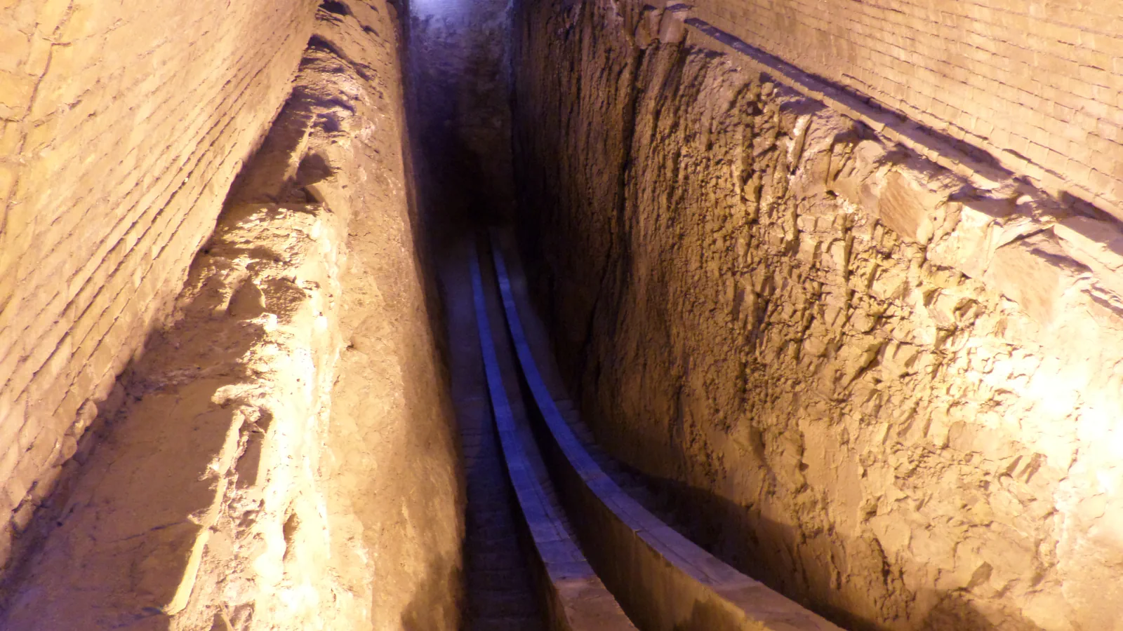
At Samarkand, V. L. Vyatkin uncovered the buried part of Ulugh Beg’s Fakhri sextant in 1908. NASA’s satellite record dates the complete disappearance of the South Aral Sea’s eastern lobe to 2014.
At a glance
- Fakhri sextant scale
- The instrument had a 40 m radius; 70 cm of scale represented one degree.[1]
- South Aral Sea
- NASA records annual water-level fluctuations from 2009 to 2018 and the eastern lobe’s complete disappearance in 2014.[2]
- Observatory main building
- Founded in 1420; about 46 m across, three storeys, roughly 30 m high.[1]
A place worth remembering
Samarkand: the observatory’s buried measuring arc
Van Dalen gives the Fakhri sextant a 40 m radius, with 70 cm on its scale representing one degree. Excavation exposed part of the instrument below ground at the observatory.[1]
South Aral Sea: one dated change in a fluctuating record
NASA’s images distinguish the eastern lobe from the western part of the South Aral Sea. The eastern lobe disappeared completely in 2014. NASA also records annual water-level fluctuations between 2009 and 2018, in alternating dry and wet years.[2]
Samarkand: the observatory’s main building
Van Dalen dates the founding of Ulugh Beg’s observatory to 1420, on a hill outside the city. He describes the circular main structure as about 46 m across, with three storeys reaching roughly 30 m above ground. The Fakhri sextant occupied its north–south axis.[1]
Good to know
A few clear answers before you explore.
Did the entire Aral Sea disappear in 2014?
No. NASA identifies the eastern lobe of the South Aral Sea as the part that disappeared. Its account also records annual water-level fluctuations between 2009 and 2018.[2]
What does 70 cm on the Fakhri sextant’s scale represent?
It represents one degree.[1]
How large was the main building of Ulugh Beg’s observatory?
Van Dalen gives about 46 m across and three storeys, reaching roughly 30 m above ground. He dates the observatory’s founding to 1420.[1]
The WorldStamped community
Every visit becomes part of a story.
- Members with public visits
- 0
- Places with public visits or memories
- 0
- Public memories
- 0
No public visits have been counted here yet. Add this destination to your own map and choose what you want to share.
Members are counted once. Counts include only eligible public activity from profiles that allow search discovery. Private and followers-only content is excluded.