🇹🇷Country
Göbekli Tepe’s buried structures and Pamukkale’s terraces
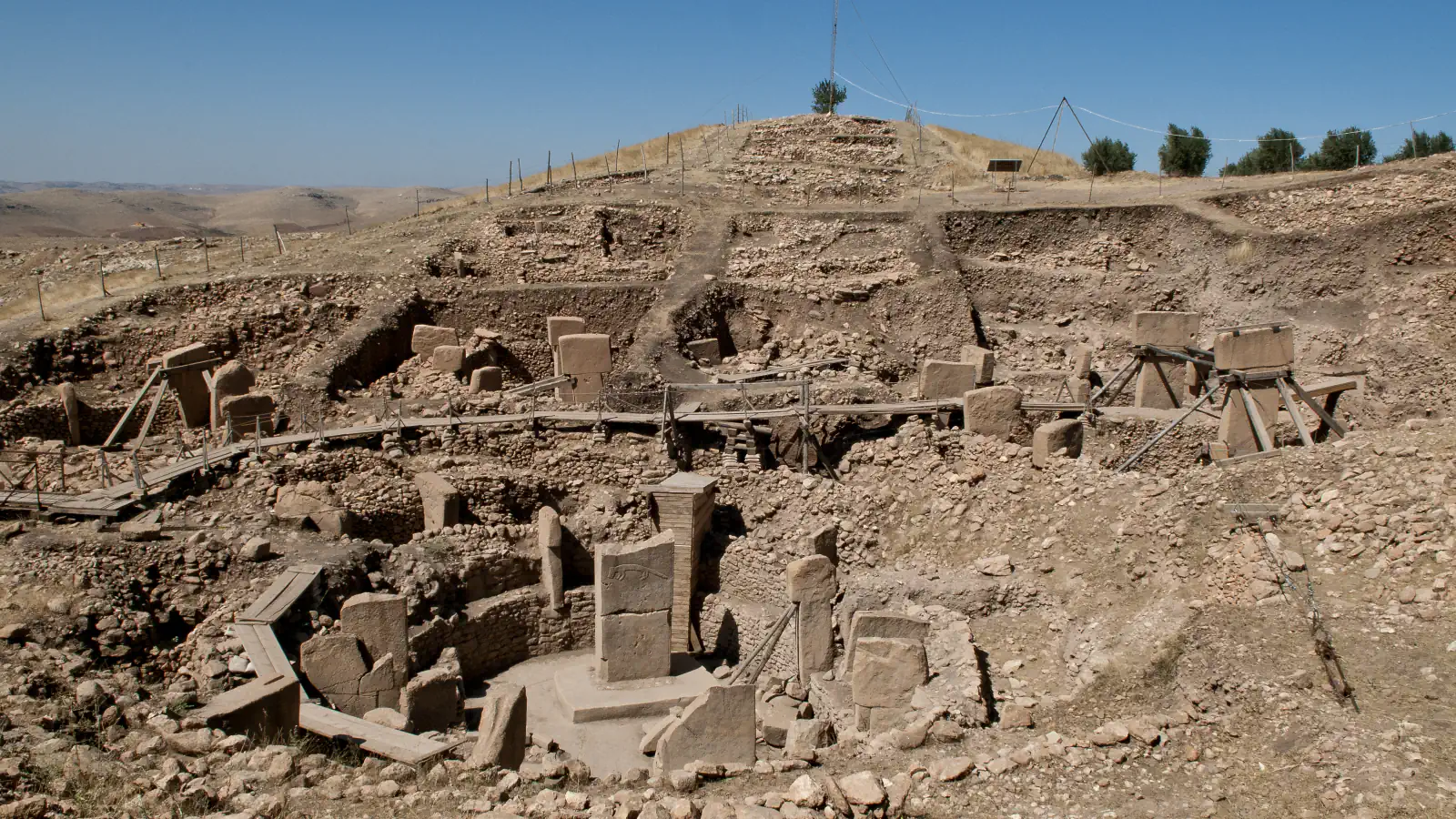
At Göbekli Tepe, geophysical surveys suggest further T-pillar buildings remain under the mound. At Pamukkale, calcite-rich springs have formed stepped basins.
At a glance
- Göbekli Tepe mound
- The German Archaeological Institute describes it as up to about 15 m high and about 9 ha in area.[2]
- Pamukkale terrace heights
- UNESCO says some are under 1 m high and others reach 6 m.[3]
- Pamukkale spring cliff
- UNESCO describes the cliff the springs emerge from as almost 200 m high.[3]
A place worth remembering
More structures may lie below the surface
Excavations to date cover a limited area at Göbekli Tepe. Ground-penetrating radar and other geophysical surveys suggest further T-pillar structures may lie below the surface. The German Archaeological Institute describes the mound as made entirely of archaeological deposits, reaching up to about 15 m high and about 9 ha in area. UNESCO dates the monumental round-oval and rectangular structures to 9,600–8,200 BCE.[1][2]
Calcite shapes Pamukkale’s white terraces
At Pamukkale, hot-spring water carrying calcite has formed petrified waterfalls, pools and step-like terraces. UNESCO says some terraces are under 1 m high and others reach 6 m; new calcium-carbonate deposits make the formations white.[3]
Hierapolis and the thermal canals
Beside the terraces lie the ruins of Hierapolis, a Hellenistic spa town that UNESCO says the Attalid kings of Pergamon founded in the late 2nd century BCE. Its Greco-Roman remains include a theatre, baths, a nymphaeum and a necropolis, as well as temple ruins. UNESCO also describes canals that channelled the spring water to neighbouring villages and farmland, part of a system reaching 70 km north-west.[3]
Good to know
A few clear answers before you explore.
What do geophysical surveys suggest remains beneath Göbekli Tepe?
Further T-pillar structures may lie below the ground; excavations to date cover a limited area.[2]
Why are Pamukkale’s terraces white?
Calcium carbonate left by the springs forms their white surface.[3]
How tall are the T-shaped pillars at Göbekli Tepe?
UNESCO says some of the limestone pillars are up to 5.50 m tall and describes them as abstract renderings of the human form.[1]
The WorldStamped community
Every visit becomes part of a story.
- Members with public visits
- 0
- Places with public visits or memories
- 0
- Public memories
- 0
No public visits have been counted here yet. Add this destination to your own map and choose what you want to share.
Members are counted once. Counts include only eligible public activity from profiles that allow search discovery. Private and followers-only content is excluded.