🇺🇬Country
Kasubi, a Bwindi–Sarambwe gorilla survey, and Lake Victoria at Jinja
Kasubi’s main tomb building was reconstructed after the 2010 fire. A 2018 survey recorded 459 gorillas across Bwindi–Sarambwe, and a separate study examines Lake Victoria outflow at Jinja against the Agreed Curve.
At a glance
- Muzibu Azaala Mpanga
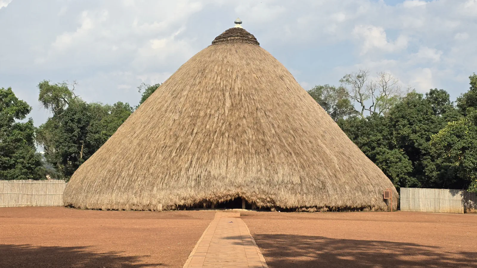
- Fire destroyed the main building in 2010; UNESCO later reported the rebuilding programme complete in summer 2023.[2][1]
- 2018 Bwindi–Sarambwe survey
- 459 across the combined 340 km² area; the report lists 50 groups and 13 solitary animals.[3]
- Lake Victoria outflow, 2018 study
- The paper reports above-curve releases after 2000; it had no outflow data available from 2006 onward.[4]
A place worth remembering
Kasubi: the form and rebuilding of a domed tomb
Muzibu Azaala Mpanga combines a circular plan and dome with materials UNESCO identifies as timber, thatch, reeds and wattle-and-daub. The hilltop structure was built as a palace in 1882 and became a royal burial place two years later. Fire destroyed the main building in 2010; UNESCO’s 2023 report says the rebuilding programme was completed that summer.[1][2]
Bwindi–Sarambwe: a 2018 mountain-gorilla survey
The 2018 survey covered a combined 340 km² across Bwindi and Sarambwe, recording 459 mountain gorillas. The report lists 50 groups and 13 solitary animals. Teams followed fresh signs to recent night-nest sites and used genetic analysis of faecal samples to distinguish individuals; they repeated the sweep in March–May and October–December that year.[3]
Jinja: Lake Victoria outflow in a dated study
A 2018 observational study places Lake Victoria’s outlet at Jinja and defines the Agreed Curve as the level-to-outflow relation under natural conditions. It reports releases above that curve after 2000. The authors report no outflow data from 2006 onward, so they held the last measured rate constant to complete their 2006–2014 model series.[4]
Good to know
A few clear answers before you explore.
When was the main Kasubi building reconstructed?
A 2010 fire destroyed it. UNESCO reports that the rebuilding programme was finished in summer 2023.[1][2]
What area did the 2018 gorilla survey cover?
It recorded 459 mountain gorillas across the combined 340 km² Bwindi–Sarambwe area. Genetic analysis of faecal samples helped identify individuals, and teams surveyed in two periods that year.[3]
What is the Agreed Curve used for in the Jinja study?
The study defines it as the relation between lake level and outflow under natural conditions. It reports releases above the curve after 2000; with no outflow data from 2006 onward, the authors held the last measured rate constant in their 2006–2014 model series.[4]
The WorldStamped community
Every visit becomes part of a story.
- Members with public visits
- 0
- Places with public visits or memories
- 0
- Public memories
- 0
No public visits have been counted here yet. Add this destination to your own map and choose what you want to share.
Members are counted once. Counts include only eligible public activity from profiles that allow search discovery. Private and followers-only content is excluded.