🇹🇼Country
Taiwan: Taroko’s marble gorge, Penghu’s shihu weirs, the Alishan railway
Taiwan’s mountains, intertidal shores and forest railway tell different stories. In Taroko, a study of marble surfaces measures river incision through the Holocene. Around Penghu, stone fish weirs mark the tidal flats. The Alishan Forest Railway starts in Chiayi and climbs into the Central Mountain Range on 762 mm track.
At a glance
A place worth remembering
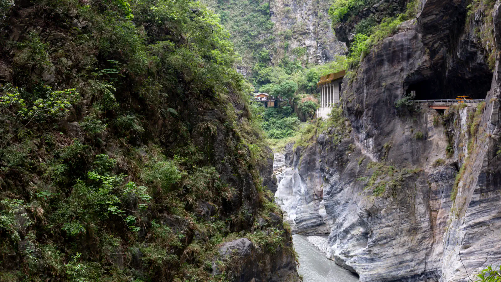
Taroko: measuring river incision in marble
Taroko’s terrain spans from the coast to Nanhu Mountain, whose summit stands at 3,742 m. The National Park Service lists its area as about 92,000 hectares and its founding date as 28 November 1986. A 2005 study used chlorine-36 exposure ages from the gorge’s marble to estimate river incision during the middle and late Holocene at 26 ± 3 mm per year. The authors describe that as a maximum estimate: the calculation assumes the gorge walls did not retreat after the river carved them.[1][2]
Penghu’s stone fishing weirs on tidal flats
Penghu’s shihu vary by design and setting. Luo and co-authors map arched forms mainly along the west and south coasts, while barriers with one or two rooms cluster around central and northern tidal flats. Their 2018 Google Earth inventory identified 539 weirs, 91% of the 592 structures in the field-checked reference catalogue. The paper separately notes that 14 weirs in the archipelago are longer than 1,000 m.[3]
Alishan: a climb from Chiayi into the mountains
The railway operator’s station pages place Chiayi at 30 m and Alishan at 2,216 m; they also list the forest railway’s 762 mm gauge beside Taiwan Railway’s 1,067 mm track on Chiayi’s first platform. The operator’s mileage table gives 71.60 km between Chiayi and Alishan, while a separate introduction page gives 71.4 km for the main line. Its station guide says Erwanping was the terminal when the railway began operating in 1912. In 2019, the Ministry of Culture designated Alishan Forestry and Railway an Important Cultural Landscape.[4][5][6]
Good to know
A few clear answers before you explore.
How high does Taroko National Park reach?
The National Park Service lists Nanhu Mountain at 3,742 m and gives sea level as the park’s low point. It places the park across Hualien, Taichung and Nantou.[1]
What are the stone weirs of Penghu?
Shihu are stone fish weirs set along Penghu’s tidal flats. Luo and colleagues’ 2018 inventory mapped 539 weirs; the paper groups them by form into arched, single-room and double-room types.[3]
How far apart are Chiayi and Alishan on the railway?
The operator’s mileage table lists 71.60 km between Chiayi and Alishan. Its station pages give their elevations as 30 m and 2,216 m, and a separate introduction page states that the main line is 71.4 km long.[4][5][6]
The WorldStamped community
Every visit becomes part of a story.
- Members with public visits
- 0
- Places with public visits or memories
- 0
- Public memories
- 0
No public visits have been counted here yet. Add this destination to your own map and choose what you want to share.
Members are counted once. Counts include only eligible public activity from profiles that allow search discovery. Private and followers-only content is excluded.