🇸🇷Country
Suriname: Paramaribo’s timber buildings, Jodensavanne cemeteries and Central Suriname
At Jodensavanne, surviving Jewish gravestones cover only part of the estimated burial count; Paramaribo’s timber buildings reflect rebuilding after two fires, and the Central Suriname Reserve protects the upper Coppename watershed.
At a glance
- Paramaribo fires
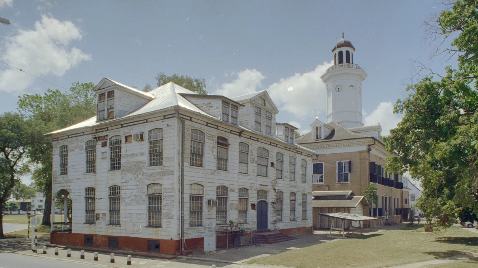
- The appended ICOMOS evaluation reports about 450 houses destroyed in 1821 and 1832; most commercial and residential buildings are wooden, and most of those wooden buildings date from after the fires.[1]
- Jodensavanne Jewish cemetery
- 462 gravestones dated 1685–1873 for an estimated 900 burials; the evaluation says nearly half had no stone marker[2]
- Central Suriname Nature Reserve
- Established in 1998 by linking three earlier reserves; 1,592,000 ha, about 11% of Suriname[3]
A place worth remembering
Paramaribo: timber rebuilding after two fires
The ICOMOS evaluation appended to the 2001 nomination reports that fires in 1821 and 1832 destroyed some 450 houses. It says most commercial and residential buildings are wooden; most of those wooden buildings date from after the fires. Local craftsmen carried out the work, and houses have brick substructures.[1]
Jodensavanne: headstones and estimated burials
ICOMOS’s March 2023 evaluation counts 462 gravestones at Jodensavanne’s Jewish cemetery dated 1685–1873, but estimates about 900 burials. It says nearly half were marked with wood instead of stone, and those wooden markers have been lost. The African-Creole cemetery at Nengre Berpe has 135 recorded graves with wooden markers; ICOMOS cautions that more graves may remain unlocated.[2]
Central Suriname Nature Reserve: forest and river headwaters
UNESCO gives the reserve’s area as 1,592,000 hectares, mostly primary tropical forest. It protects the upper Coppename watershed together with the headwaters of other rivers. The area includes granite inselbergs and the Wilhelmina Range, where Juliana Top reaches 1,230 m. UNESCO lists montane and lowland forest, swamp forest and savannah among its habitats.[3]
Good to know
A few clear answers before you explore.
How did terrain shape Paramaribo’s early street plan?
The ICOMOS evaluation appended to the nomination says the planned town started on the shell ridges in the west, whose natural drainage and firm ground suited building. It spread south along the river in the mid-18th century and north in the century’s closing years, where Dutch civil engineers drained the area.[1]
How complete is the wildlife inventory for Central Suriname?
UNESCO records 400 bird species and eight primate species, while noting that much of the reserve has yet to be inventoried. Those figures are recorded species, not a complete count of its biodiversity.[3]
What is Nengre Berpe?
ICOMOS lists it as the African-Creole cemetery in the Jodensavanne component, not far from the Jewish burial ground. It counts 135 graves with wooden markers, almost all oriented east, and assumes many more exist that have not all been located.[2]
The WorldStamped community
Every visit becomes part of a story.
- Members with public visits
- 0
- Places with public visits or memories
- 0
- Public memories
- 0
No public visits have been counted here yet. Add this destination to your own map and choose what you want to share.
Members are counted once. Counts include only eligible public activity from profiles that allow search discovery. Private and followers-only content is excluded.