🇸🇩Country
Sudan’s sandstone landmark, seasonal waterworks and manta study
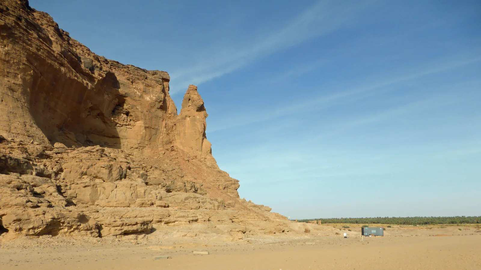
UNESCO describes Gebel Barkal as a flat-topped sandstone rock about 100 metres high. At Musawwarat, the Great Hafir collected water from Wadi es-Sufra; a 2022 study examined reef manta presence in Dungonab Bay.
At a glance
A place worth remembering
A sandstone landmark beside the Nile
UNESCO describes Gebel Barkal as a flat-topped sandstone rock about 100 metres high. It places the mountain’s sacred significance in the New Kingdom, around 1500 BCE.[1]
How the Great Hafir gathered seasonal water
A dated acoustic study of reef manta rays
UNESCO groups Dungonab Bay and Mukkawar Island as one component of a marine property in the Red Sea. A 2022 study used acoustic receivers to track Mobula alfredi in Dungonab Bay between 2 November 2012 and 24 October 2014. During the 722-day span covered by the group’s monitoring record, the array logged detections on 695 days (96%). This result describes the monitored array, not the bay’s full manta population.[4][5]
Good to know
A few clear answers before you explore.
What kind of rock is Gebel Barkal?
UNESCO describes a flat-topped sandstone rock about 100 metres high. Its account traces the mountain’s sacred significance to the New Kingdom, around 1500 BCE.[1]
How did the Great Hafir collect water?
Topoi attributes Musawwarat’s water supply to yearly summer rains. The Musawwarat project says the Great Hafir stored Wadi es-Sufra water and had inlet works that directed it toward the basin.[2][3]
Does 695 of 722 days mean the study counted 96% of the bay’s manta population?
No. The percentage describes days with detections in the receiver array, not an estimate of the number of mantas in the bay.[5]
The WorldStamped community
Every visit becomes part of a story.
- Members with public visits
- 0
- Places with public visits or memories
- 0
- Public memories
- 0
No public visits have been counted here yet. Add this destination to your own map and choose what you want to share.
Members are counted once. Counts include only eligible public activity from profiles that allow search discovery. Private and followers-only content is excluded.