🇸🇳Country
Shell-built islets in Saloum and the Djoudj wetland
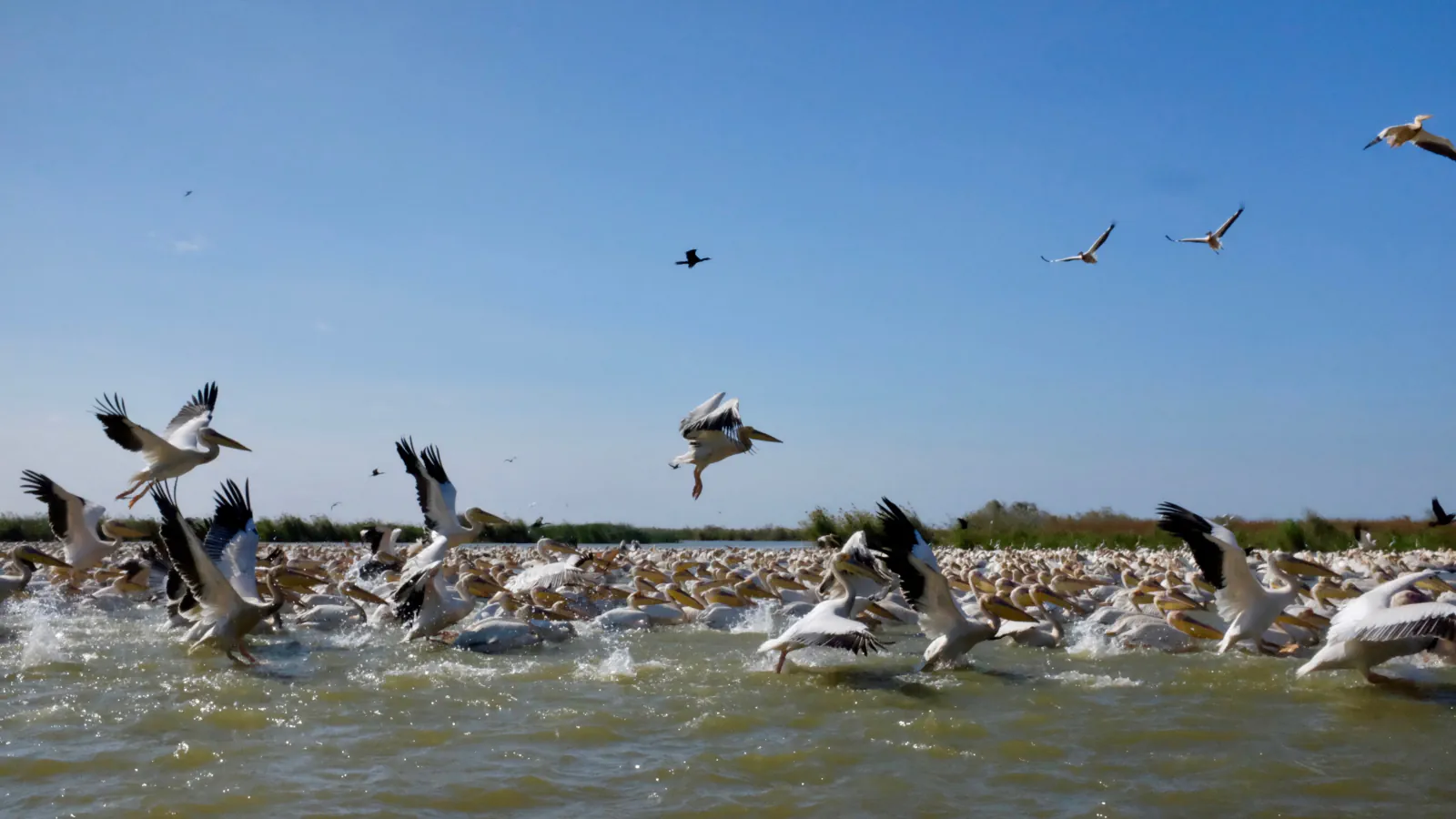
In the Saloum Delta, shell deposits became part of the landscape. At Djoudj, UNESCO describes a lake wetland and records 365 bird species.
At a glance
A place worth remembering
Shell mounds as archaeology and landform
Shell deposits are part of Saloum’s listed landscape as well as its archaeological record: UNESCO counts 218 mounds within the property, with burial tumuli on 28. The listing links long-term accumulation to durable islets and new ground in the delta.[1]
Water changes in the Djoudj wetland
UNESCO links the start-up of the downstream Diama dam with less variation in water levels, the spread of invasive aquatic plants and declines or losses among some bird colonies. The same listing describes Djoudj around a large lake in the Senegal River delta and records 365 bird species, including more than 120 Palaearctic migrants.[2]
Channels, islands and mangrove in the Saloum Delta
UNESCO describes the Saloum Delta as a 5,000 km² property shaped by the branches of three rivers. Brackish channels surround more than 200 islands and islets, and mangrove forest, dry forest and an Atlantic marine environment also lie within it. UNESCO credits fishing and shellfish gathering with supporting people there.[1]
Good to know
A few clear answers before you explore.
How did Saloum’s shell mounds affect the landscape?
UNESCO describes the accumulated shells as part of the delta’s formation: they helped create durable islets and additional land. Its listing also records burial tumuli on 28 mounds.[1]
What changes does UNESCO link to the Diama dam at Djoudj?
The listing links the downstream dam’s operation with less variation in water levels, invasive aquatic plants and declines or disappearances in some bird colonies.[2]
What does the Saloum Delta property include besides shell mounds?
UNESCO lists brackish channels around more than 200 islands and islets, along with mangrove forest, dry forest and an Atlantic marine environment, within a property of 5,000 km².[1]
The WorldStamped community
Every visit becomes part of a story.
- Members with public visits
- 0
- Places with public visits or memories
- 0
- Public memories
- 0
No public visits have been counted here yet. Add this destination to your own map and choose what you want to share.
Members are counted once. Counts include only eligible public activity from profiles that allow search discovery. Private and followers-only content is excluded.