🇲🇦Country
Morocco: a medina on two banks, an earthen ksar and a port built to a plan
Fez in the Fès-Meknès region, Aït Benhaddou in the High Atlas foothills of Ouarzazate province and Essaouira on the Atlantic coast are UNESCO World Heritage places that show how different settings shaped settlements in Morocco.
At a glance
- Essaouira
- Present town dates from 1765; laid out on a checkerboard plan[8]
A place worth remembering
Fez: two quarters by a river and the new town of Fez Jedid
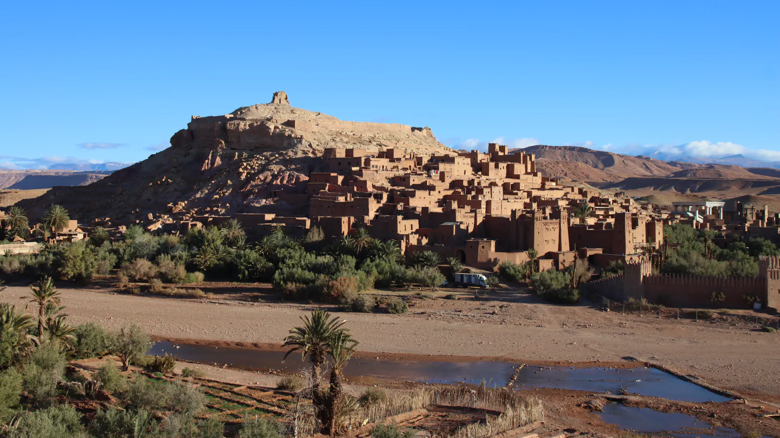
Aït Benhaddou: an earthen ksar in the Ounila Valley
The ksar stands in the southern High Atlas foothills, in Ouarzazate province; the ICOMOS evaluation places it 31 km from Ouarzazate in the Ounila Valley. It distinguishes a ksar, a cluster of households, from a kasbah associated with one family. At Aït Benhaddou, homes sit close together inside defensive walls, with towers at the corners and a zigzag entrance. Some façades use decorative clay-brick patterns. UNESCO’s inventory also includes a mosque, public square, threshing areas beyond the walls, a caravanserai, Muslim and Jewish cemeteries, a shrine and, at the village’s highest point, a fortification and a loft. The UNESCO description presents the site as one of numerous trading posts along the route it describes as linking ancient Sudan with Marrakesh through the Dra Valley and Tizi-n’Telouet pass.[4][5][6]
Essaouira: a port laid out on a checkerboard plan from 1765
The present town took shape from 1765, when Sultan Sidi Mohamed Ben Abdallah set out to build a royal port. UNESCO and ICOMOS identify Nicholas Théodore Cornut, a French military-fortification surveyor, as the planner; the layout reflects Vauban’s influence and a checkerboard street plan enclosed by walls. Two principal streets ran from Bab Doukalla toward the harbour and from Bab Marrakech toward the sea, meeting at Souk Jdid. At Souk Jdid, the ICOMOS history describes four markets, for grain, general goods, fish and spices. The medina was divided among the Kasbah, Medina and Mellah, its Jewish quarter.[7][8][9]
Good to know
A few clear answers before you explore.
How are Fez’s older quarters arranged?
Andalous and Kaïrouanais began as fortified settlements on opposite sides of the wadi. A shared wall joined them in the 11th century; Fez Jedid later developed west of Fez el-Bali in 1276.[1][2]
What does the term ksar mean at Aït Benhaddou?
UNESCO uses it for a collective settlement of earthen homes. In this village, the dwellings occupy a walled enclosure strengthened by corner towers; ICOMOS also notes the angled entrance and construction using rammed earth, moulded earth and clay brick.[4][5]
Who planned Essaouira?
The Alaouite ruler commissioned a royal port in the 18th century. The ICOMOS report names Nicholas Théodore Cornut, an Avignon surveyor specialising in military fortifications, as the planner behind the town grid and Vauban-influenced defences.[7][8]
The WorldStamped community
Every visit becomes part of a story.
- Members with public visits
- 0
- Places with public visits or memories
- 0
- Public memories
- 0
No public visits have been counted here yet. Add this destination to your own map and choose what you want to share.
Members are counted once. Counts include only eligible public activity from profiles that allow search discovery. Private and followers-only content is excluded.