🇳🇮Country
Nicaragua: a lake with tagged sharks, a monitored crater and a relocated city
Each place here comes with its own kind of data. In the south, a tagging programme begun in 1966 followed sharks moving between Lake Nicaragua and the Caribbean. In the west, the Santiago crater of Masaya volcano is watched with 13 instruments run by INETER. In the northwest, UNESCO ties the end of the first city of León to an earthquake in 1610.
At a glance
A place worth remembering
Lake Nicaragua: sharks that are not landlocked
Lake Nicaragua, also called Cocibolca, drains into the Caribbean Sea through the Río San Juan. A 1976 volume of fish studies edited by Thomas Thorson at the University of Nebraska-Lincoln reports that nineteen sharks collected in fresh water on the lake and the river were all the same species and indistinguishable from the marine bull shark, Carcharhinus leucas, of the Atlantic. The idea of a separate species trapped in the lake goes back to Gill and Bransford in 1877, who described the shark as Eulamia nicaraguensis. Thorson’s tagging programme, begun in 1966, put it to the test. When he wrote, ten of 1,450 post-juvenile sharks tagged at river mouths on the Caribbean coast had been recovered in Lake Nicaragua, and 28 of 146 sharks tagged at San Carlos, where the river leaves the lake, had been recovered along the Caribbean coast. His co-authors saw sharks both below and above the three major rapids of the river, and a hemoglobin study of 18 bull sharks from the lake, the river and the Caribbean found no significant differences in hemoglobin oxygen affinity or electrophoretic patterns. All of this is taken from the abstracts of that volume.[1][2][3][4][5]
Masaya: a crater watched by thirteen instruments
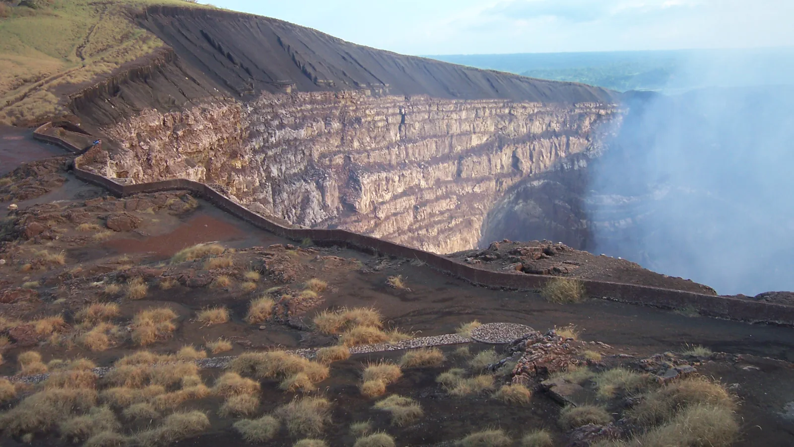
INETER, the Instituto Nicaragüense de Estudios Territoriales, says in a 2021 article in Volcanica that about 3,600,000 people, roughly 70% of the population by the census it cites, live or work at the foot of an active volcano. It dates its volcano surveillance to the April 1992 eruption of Cerro Negro. For Masaya, the article’s Table 1 lists three web cameras, one MultiGAS gas instrument, one fixed DOAS, three GNSS receivers and five seismic stations. INETER writes that a basaltic lava lake appeared at the bottom of the Santiago crater in December 2015, and that the last time one had been seen there was December 1999, although that sighting was not officially reported. A separate study by Aiuppa and colleagues dates the lake’s onset to 11 December 2015 from satellite thermal data and found the gas plume unusually rich in CO2 beforehand, with CO2 output peaking in November 2015. These are papers from 2018 and 2021, not a current activity report.[5][6]
León Viejo: a city that moved after 1610
UNESCO places the ruins of León Viejo near Puerto Momotombo, opposite Momotombo volcano at the western end of Lake Managua. Francisco Hernández de Córdoba founded the city in 1524. According to UNESCO, an eruption of Momotombo in 1578 partly destroyed it and an earthquake in 1610 destroyed what remained, after which the decision was taken to rebuild six leagues away. The gradual burial of the site preserved the remains until their discovery in 1967. The ruins extend over 31.87 ha, and 17 colonial structures had been found when UNESCO wrote its summary, among them the Cathedral of Santa María de la Gracia, the La Merced church and convent and the Casa de la Fundición, all built of tapial. UNESCO adds that the Calle Real and the Plaza Mayor are clearly defined. The same Momotombo erupted again on 1 December 2015 after 110 years of rest, according to INETER.[7][5]
Good to know
A few clear answers before you explore.
Are the sharks of Lake Nicaragua a separate species?
Not according to the 1976 studies. Nineteen sharks taken from fresh water on the lake and the Río San Juan were all the same species as the marine bull shark, and a hemoglobin study of 18 sharks from the lake, the river and the Caribbean found no significant differences in hemoglobin oxygen affinity or electrophoretic patterns. That study adds that bull sharks have had free access to the lake, and have been there at least since 1535.[2][4]
How does INETER keep watch on Masaya?
With seismic stations, GNSS receivers, web cameras and gas instruments. INETER’s 2021 article lists five seismic stations, three GNSS receivers, three web cameras, one MultiGAS and one fixed DOAS at Masaya, 13 instruments in all, and says its volcano monitoring began after the April 1992 eruption of Cerro Negro.[5]
What ended the first city of León?
UNESCO says an eruption of Momotombo in 1578 partly destroyed it and an earthquake in 1610 destroyed what remained, after which it was decided to rebuild the city six leagues away. The ruins lay buried until their discovery in 1967.[7]
The WorldStamped community
Every visit becomes part of a story.
- Members with public visits
- 0
- Places with public visits or memories
- 0
- Public memories
- 0
No public visits have been counted here yet. Add this destination to your own map and choose what you want to share.
Members are counted once. Counts include only eligible public activity from profiles that allow search discovery. Private and followers-only content is excluded.