🇲🇿Country
Island building traditions and wildlife survey results in Mozambique
On Ilha de Moçambique, stone-and-lime homes in the north contrast with palm-roofed macuti houses in the south. A 2019 study documents a changed wildlife mix in Gorongosa by 2018, while a WWF survey in Bazaruto in 2008 produced two dugong estimates that depend on how groups were measured.
At a glance
- Macuti house described in the 2011 abstract
- One storey; mangrove, stone, earth and lime; palm-frond roof[2]
- Gorongosa biomass and species balance in 2018
- In the common Rift Valley count block, biomass of nine focal species was about 95% of its 1969–1972 survey mean; waterbuck exceeded 74% of the nine-species total in 2018.[3]
- Dugong sightings during the 2008 survey
- 9, 22 and 135 on the three official survey days[4]
A place worth remembering
Stone and lime in the north, macuti roofs in the south
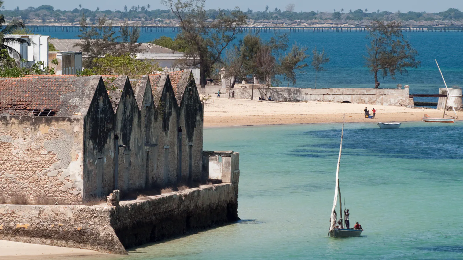
UNESCO distinguishes the island’s northern stone-and-lime town from the southern macuti quarter, named for its palm-leaf roofs. In Sollien’s 2011 conference-paper abstract, a typical macuti house is a single-storey Swahili dwelling; the abstract also notes later preference for cement blocks and zinc-sheet roofing.[1][2]
Biomass near the baseline, but a different wildlife mix
Within the common Rift Valley count block, biomass for the nine focal large-herbivore species reached about 95% of the 1969–1972 survey mean by 2018. The near-recovery in total masks a changed mix: waterbuck alone made up more than 74% of those species’ biomass.[3]
What a three-day dugong survey could estimate
The 2008 WWF report separates sightings from population estimates. Observers counted 9, 22 and 135 dugongs on three survey days along a 521 km route; two methods for estimating group size yielded abundance estimates of 112 and 463, each with wide confidence intervals. The authors say the variable counts and differences among older survey methods do not establish an increase.[4]
Good to know
A few clear answers before you explore.
How do UNESCO and the 2011 abstract distinguish the island’s building traditions?
UNESCO places stone-and-lime buildings in the northern town and describes the southern macuti quarter by its palm-leaf roofs. Sollien’s abstract calls a typical macuti house a single-storey Swahili dwelling and notes later preference for cement blocks and zinc roofing.[1][2]
What did the 2019 study compare in Gorongosa?
In the common Rift Valley count block, the nine focal species’ biomass was about 95% of its 1969–1972 survey mean by 2018. Waterbuck accounted for over 74% of that total.[3]
What did the Bazaruto survey observe, and what did it estimate?
On three official days in May 2008, observers counted 9, 22 and 135 animals along the 521 km route. Two ways of estimating group size produced population estimates of 112 (95% confidence interval 53–237) and 463 (155–1,378); the report cautions that those variable observations do not show an increase.[4]
The WorldStamped community
Every visit becomes part of a story.
- Members with public visits
- 0
- Places with public visits or memories
- 0
- Public memories
- 0
No public visits have been counted here yet. Add this destination to your own map and choose what you want to share.
Members are counted once. Counts include only eligible public activity from profiles that allow search discovery. Private and followers-only content is excluded.