🇲🇭Country
Marshall Islands: reef change, drought water and a copra-era village
Three records offer different kinds of evidence: a Bikini coral comparison published in 2008, USGS well measurements at Laura during the 1998 drought, and Likiep’s 2005 historic-district entry on UNESCO’s Tentative List.
At a glance
- Bikini coral comparison, 2002
- 183 species in the 2002 list; 28 possible genuine local losses after the authors’ caveat[1]
- Laura freshwater lens, June 1998
- About 45 ft thick near its middle; 25–38 ft toward the northern and southern ends[2]
- Likiep historic-district entry
- About 15 significant buildings or remains dated 1880–1937[3]
A place worth remembering
Bikini: a mixed picture from the 2002 coral comparison
Richards and colleagues assessed whether apparent coral losses on Bikini could be genuine. The Australian Museum abstract says 28 of 42 possible local losses appear genuine; taxonomy or sampling differences may explain the other 14. That qualification is central to reading the historical comparison.[1]
Laura: groundwater through the 1998 drought
At the end of the 1998 drought, in June, the USGS found Laura’s freshwater lens about 45 feet (14 m) thick near its middle and 25–38 feet (8–12 m) at its northern and southern ends. Groundwater supplied 90 percent of drinking water in March and 64 percent in May. These measurements connect the local lens to the community’s water supply during the shortage; they describe Laura, not every island in Majuro Atoll.[2]
Likiep: buildings read as evidence of an economic shift
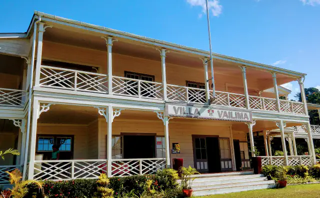
The Alele Museum’s 2005 UNESCO Tentative List entry counts about 15 significant buildings or remains in Likiep Village Historic District, dated 1880–1937. It treats the village fabric as evidence of copra commerce and shifts in architecture, cash exchange and religious life. This is a Tentative List submission, not an inscription decision.[3]
Good to know
A few clear answers before you explore.
How should the Bikini coral comparison be read?
The abstract says 28 of 42 possible local losses appear genuine; taxonomy or sampling differences may explain the other 14. That uncertainty is part of the historical comparison.[1]
What does the Likiep heritage entry document?
It lists about 15 significant structures or remains from 1880–1937 and interprets the village landscape through the copra trade and changes in local architecture and cash exchange.[3]
Why did groundwater in Laura matter during the 1998 drought?
USGS reports that groundwater from Laura’s freshwater lens supplied 90 percent of drinking water in March and 64 percent in May during the 1998 drought.[2]
The WorldStamped community
Every visit becomes part of a story.
- Members with public visits
- 0
- Places with public visits or memories
- 0
- Public memories
- 0
No public visits have been counted here yet. Add this destination to your own map and choose what you want to share.
Members are counted once. Counts include only eligible public activity from profiles that allow search discovery. Private and followers-only content is excluded.