🇱🇹Country
Lithuania: shifting dunes, a hill of crosses and a reused castle tower
From wind-shaped dunes on the Curonian Spit to crosses near Šiauliai and a reused castle tower in Vilnius, Lithuania’s selected sites reflect landscape change and the later use of older structures.
At a glance
A place worth remembering
Curonian Spit: settlements and dunes in a changing landscape
Wind, waves and people have all shaped the Curonian Spit between the Baltic Sea and Curonian Lagoon. Neringa’s tourism information records that moving sand displaced Nida several times before the settlement reached its present site in 1730. Pervalka, meanwhile, was founded in 1844 by residents of Naujieji Nagliai, a village buried by sand. UNESCO relates the dunes’ lagoonward advance and the burial of villages to heavy tree-felling in the 1600s and 1700s; it says stabilisation began around 1800 and is still underway.[1][2]
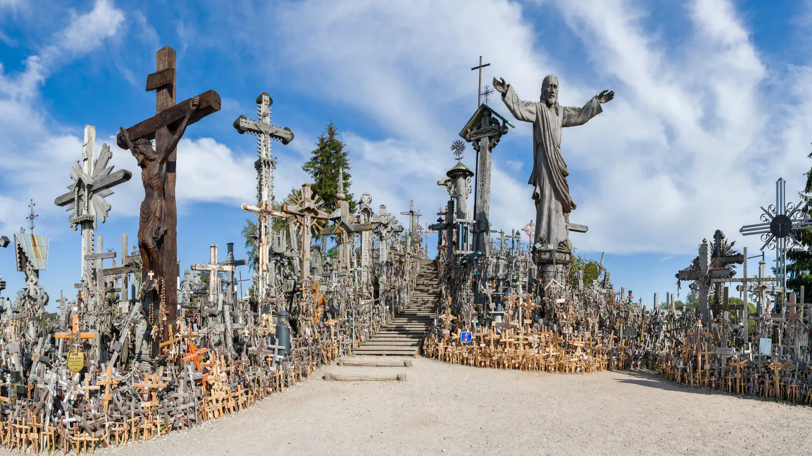
Hill of Crosses: dated records of a devotional place
A cross-covered hill stands in the countryside roughly 12 kilometres north of Šiauliai, beside the Kulpė stream. The Catholic information site dates the hill’s first written mention to the mid-19th century and records a 14-station Way of the Cross established around 1888. It reports about 200,000 crosses counted there in 2007.[4][5]
Gediminas’ Tower: a castle remnant put to new uses
The National Museum of Lithuania dates a major alteration to 1832–1834: the top two floors came down, leaving two octagonal tiers beneath a six-sided wooden frame built for optical signalling. Go Vilnius dates the tower’s use as the city’s telegraph building to 1838. In 1895 it became a city fire-watch post; a museum opened there in 1960.[6][7]
Good to know
A few clear answers before you explore.
Why are dune-stabilisation works part of the Curonian Spit’s story?
UNESCO links the landscape’s survival with ongoing work to stabilise dunes and reforest the spit. Wind and waves keep reshaping this sandy peninsula.[1]
Is there one documented origin for the crosses?
The Šiauliai tourism account gives more than one explanation and does not establish a single origin. It includes a local story that early crosses were placed as prayers for good health.[5]
When was the tower’s telegraph structure added?
The National Museum of Lithuania dates the wooden optical-telegraph structure to 1832–1834. Go Vilnius separately dates the tower’s use as the city telegraph building to 1838.[6][7]
The WorldStamped community
Every visit becomes part of a story.
- Members with public visits
- 0
- Places with public visits or memories
- 0
- Public memories
- 0
No public visits have been counted here yet. Add this destination to your own map and choose what you want to share.
Members are counted once. Counts include only eligible public activity from profiles that allow search discovery. Private and followers-only content is excluded.