City
Bridgetown: Careenage and the synagogue burial ground
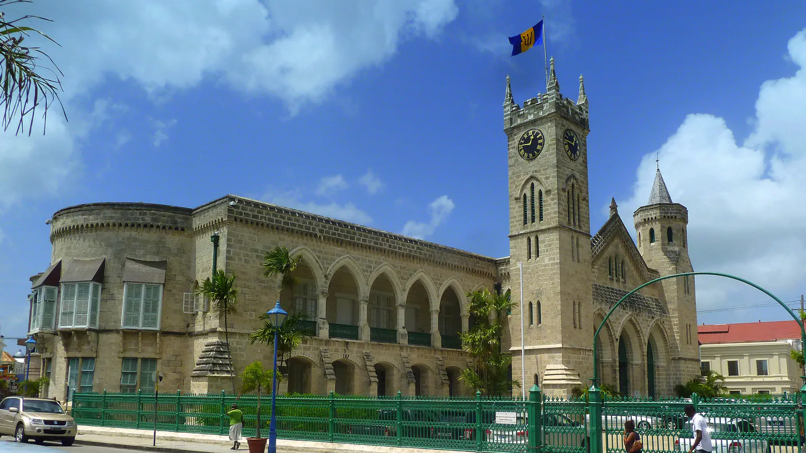
At the Careenage, shallow-draft rowboats ferried cargo between Bridgetown’s waterfront and larger ships in Carlisle Bay. Historian Karl Watson says an 1869 indenture confirms shops stood on the Nidhe Israel synagogue’s burial ground. At the Parliament Buildings, the clock moved west after its original East Wing tower sank in weak ground, according to Parliament’s history.
At a glance
A place worth remembering
Careenage: cargo from the basin to ships offshore
The hydraulic lift bridge in place since 2006 replaced the two-person swing Chamberlain Bridge, which opened the inner basin to traffic. ICOMOS dates the swing bridge to 1872; Barbados.org gives 1865–72 for its construction. ICOMOS describes shallow-draft lighters running between the basin and larger ships anchored in Carlisle Bay, taking sugar, rum and molasses out and bringing imported goods and passengers back. ICOMOS’s 2011 evaluation records that part of the waterfront was designated a public wharf in 1657.[1][2]
Nidhe Israel: the burial ground beneath shop floors
In a 2021 AJHS interview, historian Karl Watson traces four shops on the Nidhe Israel synagogue burial ground to a letter-book entry confirmed by an indenture dated 6 May 1869. Restoration later exposed 17 whole flat ledger stones beneath the shop floors, dated 1752–1823. Watson says some fragments were probably broken during the construction. Their epitaphs appear in Hebrew, Spanish or Portuguese, and English. AJHS dates the synagogue to around 1654.[3][1]
The Parliament clock’s move to the West Wing
The clock now stands in the West Wing. Parliament’s history says its tower began on the East Wing and sank there, with silted sand in the subsoil failing to hold the weight. Parliament’s page calls the subsoil silted sand; a 2025 Barbados National Trust leaflet describes it as mainly mud. Parliament dates the tower’s dismantling to 1884 and the clock and bells’ move to late 1885 or early 1886. Its page gives a 14-foot (about 4.3 m) pendulum and 7-foot (about 2.1 m) copper dials; the clock is built to keep going for eight days between windings.[4][5]
Good to know
A few clear answers before you explore.
How did ICOMOS describe the Careenage’s use?
In its 2011 evaluation, ICOMOS described pleasure craft as the basin’s main users at that time.[1]
What did restoration uncover beneath the shops?
Watson reports 17 whole ledger stones dated 1752–1823, along with fragments likely broken during the shops’ construction. An indenture of 6 May 1869 confirms the four shops stood on the burial ground.[3]
Why was the Parliament clock moved to the West Wing?
The Parliament history says the East Wing tower sank into silted sand because the subsoil there was too weak to hold it. A 2025 National Trust leaflet describes that soil as mainly mud; Parliament calls it silted sand.[4][5]
The WorldStamped community
Every visit becomes part of a story.
- Members with public visits
- 0
- Places with public visits or memories
- 0
- Public memories
- 0
No public visits have been counted here yet. Add this destination to your own map and choose what you want to share.
Members are counted once. Counts include only eligible public activity from profiles that allow search discovery. Private and followers-only content is excluded.