City
Reef terraces and karst in Santo Domingo
La Isabela’s reef limestone forms a stepped coastal landscape. IGME’s 2015 mapping names the levels by their position in the terrain and treats the higher Los Haitises surface separately.
At a glance
- Country
- At least three La Isabela levels (Inferior, Media, Superior); a higher surface at about +70 m is cut into the Los Haitises Formation[2]
- Raised reef levels
- At least three La Isabela levels at about +12, +25 and +35 m; a separate +70 m surface belongs to Los Haitises[1]
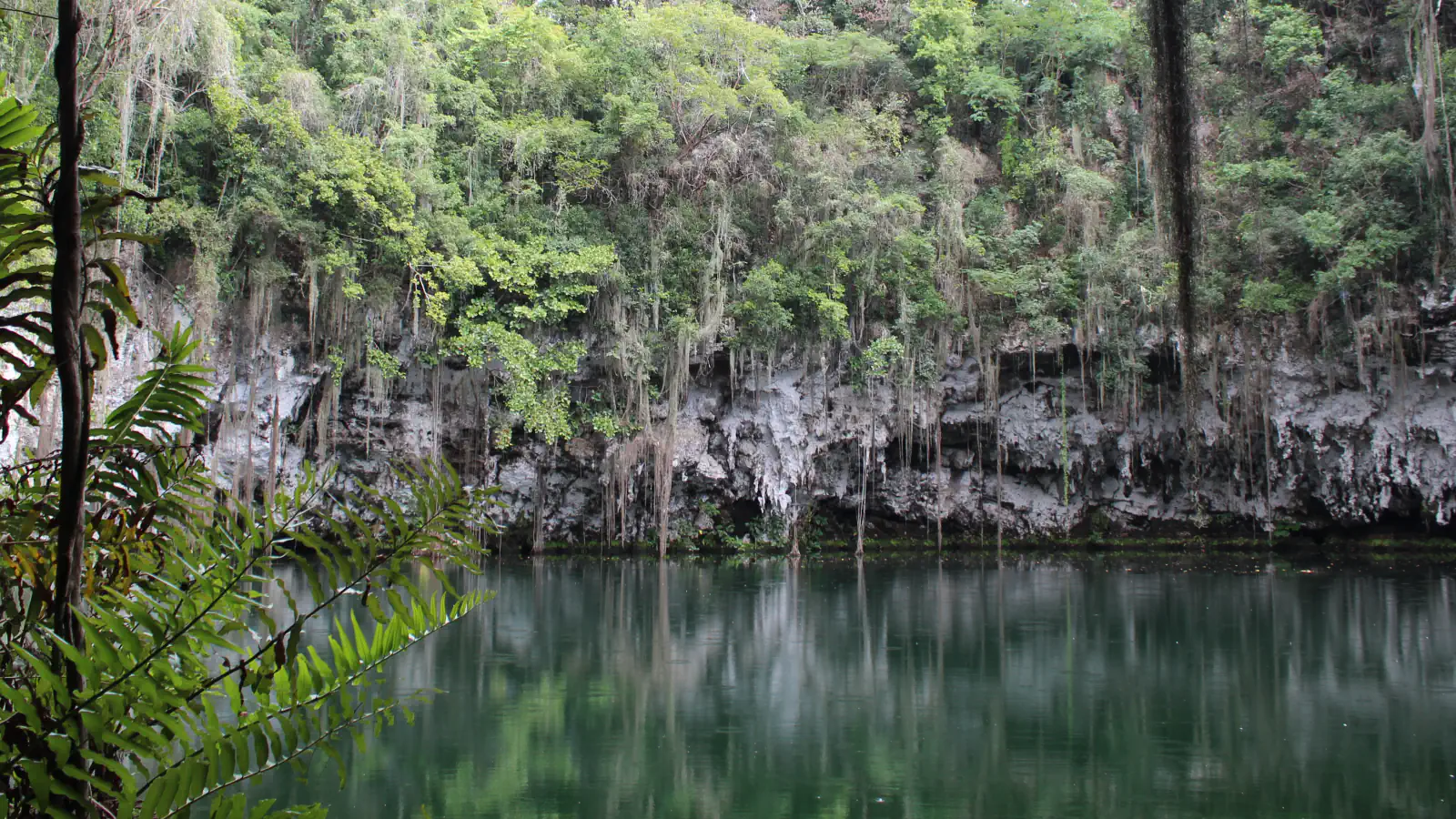
- Lago Zaramagullones
- The 2015 IGME caption identifies it as a collapse doline in the La Isabela Formation.[1]
A place worth remembering
Levels in the coastal limestone
IGME maps at least three La Isabela platforms in the coastal plain and names them Inferior, Media and Superior; it says they differ basically in their topographic position. A higher surface of the coastal plain, at about +70 m and cut into the Los Haitises Formation, may in the report’s view be the oldest abrasion platform.[1]
Coral preserved in the rock
The report describes La Isabela as coral limestone. Some coral colonies are preserved in growth position; others are toppled to varying degrees. Many have red coralline-algal crusts, and sediment between them contains fragments of coral and other marine organisms.[1]
Karst features on the map
The 2015 map records dolines in the limestone. At Los Prados, it notes flooding after heavy rain and links street subsidence to limestone dissolution and removal. A caption identifies Lago Zaramagullones at Los Tres Ojos in Santo Domingo Este as a collapse doline in La Isabela.[1]
Good to know
A few clear answers before you explore.
What names are used for the mapped La Isabela levels?
Inferior, Media and Superior. The report says the levels differ basically in their topographic position.[1]
What does the report describe in the La Isabela limestone?
Some coral colonies remain in growth position while others are toppled to varying degrees; many have red coralline-algal crusts, with marine fragments in the sediment between them.[1]
What is Lago Zaramagullones?
The 2015 memoir caption identifies the lake at Los Tres Ojos, Santo Domingo Este, as a collapse doline in the La Isabela Formation.[1]
The WorldStamped community
Every visit becomes part of a story.
- Members with public visits
- 0
- Places with public visits or memories
- 0
- Public memories
- 0
No public visits have been counted here yet. Add this destination to your own map and choose what you want to share.
Members are counted once. Counts include only eligible public activity from profiles that allow search discovery. Private and followers-only content is excluded.