🇭🇰Country
Hong Kong: volcanic columns, shrimp ponds for birds and a time ball
The volcanic rock columns of High Island in Sai Kung in the east, the wetlands of Mai Po and Deep Bay in the north-west, and the Observatory at Tsim Sha Tsui in Kowloon cover three parts of Hong Kong. They are a geopark landform, a managed wetland and a scientific institution. Other parts of Hong Kong are not covered here.
At a glance
A place worth remembering
High Island: columns left by an eruption
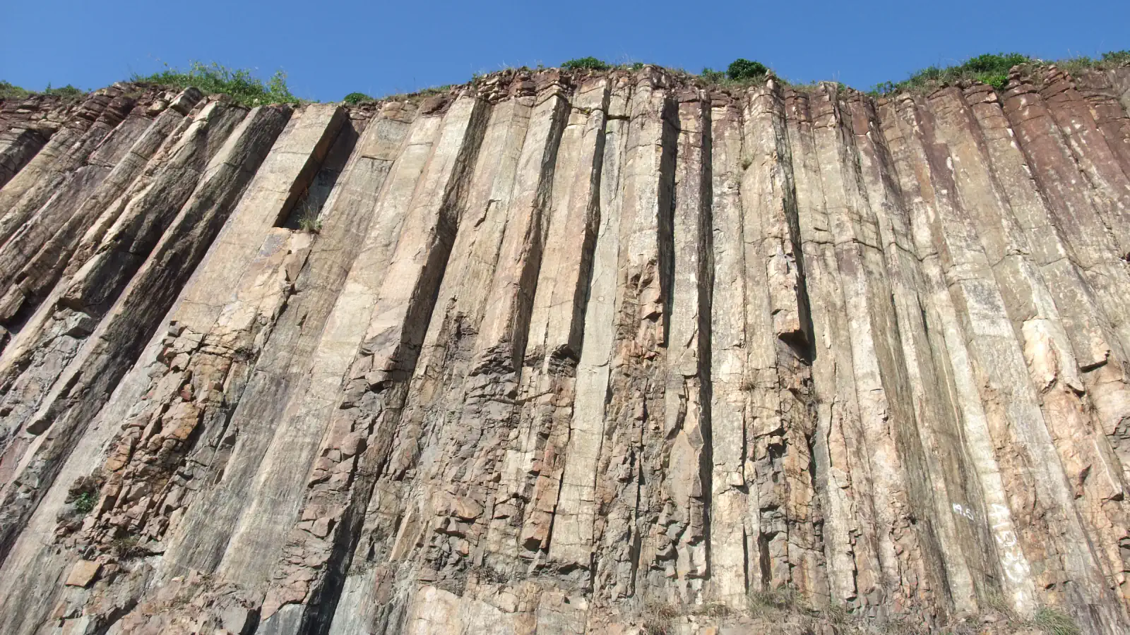
At the East Dam of High Island Reservoir in Sai Kung East Country Park, cliffs show columns of the High Island Formation, which is among the First 100 IUGS Geological Heritage Sites. UNESCO notes that hexagonal columns elsewhere are usually dark basalt, whereas these are light-coloured rhyolite rich in silica. IUGS dates the formation to 140–141 million years ago and calls it the relic of an Early Cretaceous supervolcano whose ash totalled 1,300 km³, citing Sewell and colleagues (2019). The columns formed as ash cooled and contracted inside the caldera, and the rock contains up to 76% silica. They average 1.2 m across, the widest about 3 m, and in places stand up to 100 m above sea level. A 2012 paper by Sewell, Tang and Campbell describes the High Island tuff as a single cooling unit of densely welded tuff preserved in a collapsed caldera. The High Island Geo Trail runs along the East Dam.[1][2][3]
Mai Po and Deep Bay: shrimp ponds run for birds
Mai Po Marshes and Inner Deep Bay, a Ramsar site since 1995, covers 1,540 ha in the north-west: mudflats, mangrove, fishponds, reedbed and gei wais. Gei wais are tidal shrimp ponds that were made from the mangrove in the 1930s by building bunds around it. They are drained in rotation through the winter and kept dry for a long period, so that waterbirds can feed on the small fish and invertebrates left behind. Most are now managed as roosts and feeding grounds for migratory birds or as freshwater habitat for dragonflies. The information sheet of 2012 reports an average of 83,034 waterbirds in mid-winter in 2007–2012, and says the site regularly held over 20% of the world’s Black-faced Spoonbills, with a known winter maximum of 496 birds.[4][5]
Tsim Sha Tsui: an observatory with a time ball
The Hong Kong Observatory was established in 1883 on a small hill in Tsim Sha Tsui. Regular weather observations began in 1884, the year it also set up a tropical cyclone warning system: visual signals for ships and a typhoon gun for the public. In 1885 a time ball at the Tsim Sha Tsui police station was dropped for the first time. It was raised halfway at 12:55 pm, to the top at 12:57 and lowered at exactly 1 pm. A new tower on Signal Hill replaced it in 1908, and the time ball was used until 1933. The 1883 Building, a two-storey plastered brick building with arched windows and long verandas, was declared a monument in 1984 and stands at 134A Nathan Road. The Observatory’s Seismograph Cellar was built in 1923.[6][7][8][9]
Good to know
A few clear answers before you explore.
How do the High Island columns differ from basalt columns?
UNESCO says hexagonal columns elsewhere are usually dark-grey basalt with little silica, while the High Island Formation is light-coloured rhyolite rich in silica. IUGS gives a silica content of up to 76%.[1][2]
Why are the gei wais at Mai Po drained in winter?
To attract waterbirds. The Ramsar information sheet says they are drained in rotation and kept dry for a long period so that birds can feed on the small fish and invertebrates left behind.[5]
What did the Observatory’s time ball do?
It gave a daily time signal. The ball was raised halfway at 12:55 pm and to the top of the mast at 12:57, then lowered at exactly 1 pm, first at the Tsim Sha Tsui police station in 1885. It was used until 1933.[6][7]
The WorldStamped community
Every visit becomes part of a story.
- Members with public visits
- 0
- Places with public visits or memories
- 0
- Public memories
- 0
No public visits have been counted here yet. Add this destination to your own map and choose what you want to share.
Members are counted once. Counts include only eligible public activity from profiles that allow search discovery. Private and followers-only content is excluded.