🇸🇬Country
Singapore: Boat Quay, rubber and Ubin’s granite pits
A Battery Road hillock supplied earth for Boat Quay’s marshy south bank in 1823. Eleven Para rubber seedlings from Kew were planted at the Botanic Gardens in 1877; Pulau Ubin’s granite quarries later became inactive sites used as viewpoints and wildlife habitat.
At a glance
A place worth remembering
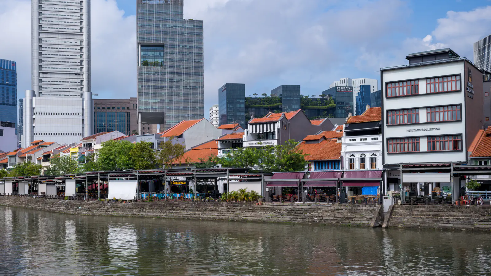
Boat Quay: filling a marshy riverbank
URA says earth from a Battery Road hillock, levelled in 1823, was used to fill the Singapore River’s swampy south bank and create Boat Quay. The promenade was raised in a late-1980s flood measure, with a lift equal to three quay steps. Separately, 19th-century granite stairs at the river edge were kept during bank restoration.[1]
From Kew seedlings to rubber research
A planting at the Gardens links experimentation with the region’s rubber story: NParks dates eleven Para seedlings from Kew, planted by Henry James Murton, to 1877. The Heritage Tree profile says they are believed to have supplied the trees that began the regional industry. The Gardens’ history describes Henry Nicholas Ridley’s later work on latex extraction and his efforts to persuade planters to grow rubber.[3][2]
Pulau Ubin’s former granite quarries
NParks describes six granite quarries on Pulau Ubin, all inactive now. Mining reached around 40 m below sea level; the former pits have since been adapted as viewpoints and wildlife habitat. For Ketam, formerly Aik Hwa, NParks records closure in May 1999.[4]
Good to know
A few clear answers before you explore.
Where did the ground at Boat Quay come from?
URA says earth from a Battery Road hillock, levelled in 1823, was used to fill the Singapore River’s swampy south bank and form Boat Quay.[1]
What link does NParks make between Kew and the regional rubber industry?
The Heritage Tree profile says the eleven seedlings planted in 1877 are believed to have supplied the trees that began the industry. The Gardens’ history describes Ridley’s later latex research.[3][2]
When did Ketam Quarry close?
NParks records May 1999 as the closure date for Ketam, formerly Aik Hwa.[4]
The WorldStamped community
Every visit becomes part of a story.
- Members with public visits
- 0
- Places with public visits or memories
- 0
- Public memories
- 0
No public visits have been counted here yet. Add this destination to your own map and choose what you want to share.
Members are counted once. Counts include only eligible public activity from profiles that allow search discovery. Private and followers-only content is excluded.