🇬🇱Country
Greenland: Norse farm remains and an icefjord
Southern Greenland’s Kujataa preserves Norse farm remains within a landscape shaped by Inuit farming since the late 18th century. On Greenland’s west coast, Sermeq Kujalleq carries ice from the ice cap through Ilulissat Icefjord into the sea.
At a glance
A place worth remembering
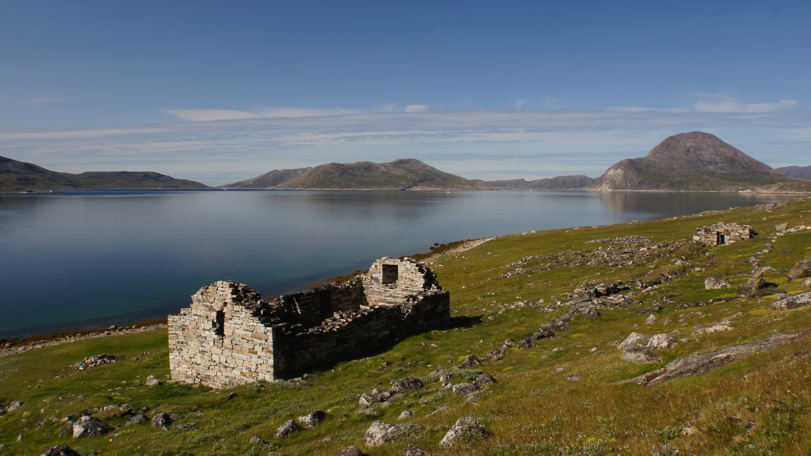
The church at Hvalsey is within Kujataa
UNESCO maps Kujataa as five separate components in southern Greenland. The Norse church ruin at Hvalsey, shown here, lies within the Qaqortukulooq (Hvalsey) component.[2]
Two farming periods in one landscape
Where Sermeq Kujalleq meets the sea
UNESCO reports that Sermeq Kujalleq moves about 40 metres per day. Its listing also notes more than 250 years of research that contributed to understanding climate change and ice-cap glaciology.[4]
Good to know
A few clear answers before you explore.
Is the Hvalsey church a separate Kujataa component?
No. UNESCO lists Qaqortukulooq (Hvalsey) among Kujataa’s five components; the church ruin is within that area.[2]
Which periods of farming are documented in Kujataa?
UNESCO dates Norse farm sites in Kujataa to the 10th–15th centuries and identifies Inuit farming from the 1780s, continuing to the present.[1]
What speed does UNESCO give for Sermeq Kujalleq?
UNESCO reports that Sermeq Kujalleq moves about 40 metres per day and notes that the glacier has been studied for over 250 years, contributing to climate and ice-cap science.[4]
The WorldStamped community
Every visit becomes part of a story.
- Members with public visits
- 0
- Places with public visits or memories
- 0
- Public memories
- 0
No public visits have been counted here yet. Add this destination to your own map and choose what you want to share.
Members are counted once. Counts include only eligible public activity from profiles that allow search discovery. Private and followers-only content is excluded.