🇨🇱Country
Chile in three places: Atacama telescopes, Rapa Nui and Chiloé
ALMA’s 66 antennas sit on the Chajnantor plateau at 5,000 m. On Rapa Nui, UNESCO describes Orongo’s semi-subterranean stone houses and petroglyphs; on Chiloé, UNESCO says churches were deliberately set on hills so that navigators could see them and floods would not reach them.
At a glance
A place worth remembering
Atacama: observatories above the desert
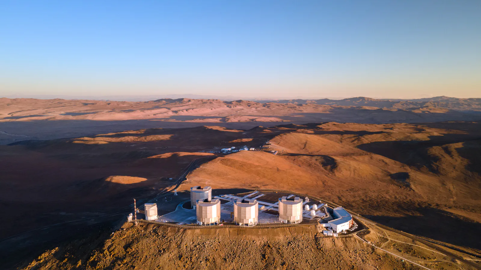
ESO places Cerro Paranal at 2,635 m above sea level, roughly 120 km south of Antofagasta and 12 km from the Pacific coast. Its Very Large Telescope combines four 8.2 m Unit Telescopes—Antu, Kueyen, Melipal and Yepun—with four movable 1.8 m Auxiliary Telescopes. ALMA’s 66 antennas operate from the Chajnantor plateau at 5,000 m, about 40 km east of San Pedro de Atacama.[1][2][3][4]
Rapa Nui: Orongo’s stone houses and petroglyphs
UNESCO estimates the distance between Rapa Nui and continental Chile at 3,700 km. Its record counts about 900 moai statues and more than 300 ceremonial ahu platforms. At the Rano Kau volcano, the sacred village of Orongo has 54 semi-subterranean stone houses and numerous petroglyphs.[5]
Chiloé: wooden churches set on hills for the sea
About 70 churches on the Chiloé archipelago grew out of a Jesuit “Circular Mission” that the Franciscans later continued, and UNESCO inscribed sixteen of them, among them Achao, Castro, Chonchi, Dalcahue and Tenaún. UNESCO notes that the towers and roofs show a strong influence of boat-building, and that the churches were placed on hills deliberately, so that navigators could see them and floods would not reach them. A storm brought down the tower of the church at Chonchi in March 2002, and UNESCO says the wooden buildings need constant conservation.[6]
Good to know
A few clear answers before you explore.
How many Unit Telescopes make up ESO’s Very Large Telescope?
The VLT has four 8.2 m Unit Telescopes—Antu, Kueyen, Melipal and Yepun. Four movable 1.8 m Auxiliary Telescopes are also available for interferometry.[2]
How many semi-subterranean houses does UNESCO describe at Orongo?
The UNESCO entry counts 54 stone houses at the ceremonial village on Rano Kau and notes petroglyphs there.[5]
Why do the Chiloé churches stand on hills?
UNESCO says their location was a deliberate response to the sea: on hills so that navigators could see them and so that floods would not reach them. UNESCO adds that the esplanades beside them express the link with the sea and remain settings for religious festivals.[6]
The WorldStamped community
Every visit becomes part of a story.
- Members with public visits
- 0
- Places with public visits or memories
- 0
- Public memories
- 0
No public visits have been counted here yet. Add this destination to your own map and choose what you want to share.
Members are counted once. Counts include only eligible public activity from profiles that allow search discovery. Private and followers-only content is excluded.