🇧🇿Country
Belize through reef sediments, Maya terrain and jaguar research
Sediment from the Great Blue Hole, terrain mapping at Caracol and camera traps in Cockscomb Basin each reveal a different pattern: cyclone layers, a connected Maya landscape and individually recognisable jaguars.
At a glance
A place worth remembering
A cyclone archive in the Great Blue Hole
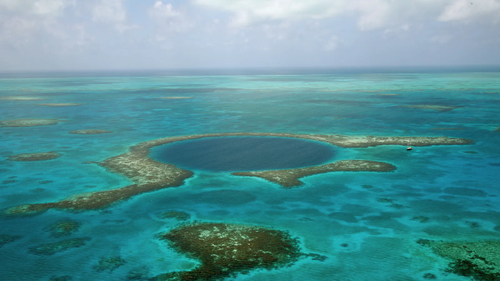
At Lighthouse Reef, the Great Blue Hole is a marine sinkhole within the Blue Hole Natural Monument. The 2017–2021 management plan puts Lighthouse Reef Atoll roughly 80 km from Belize City in an east-south-easterly direction; UNESCO lists the monument as one of seven protected areas in the Belize Barrier Reef Reserve System. A six-day coring operation in June 2022 recovered a 30 m sediment core. Schmitt, Gischler and colleagues report annual layers and 694 event layers; varve counts checked against radiocarbon dates underpin their reconstruction of tropical-cyclone frequency across 5,700 years. This is an environmental archive interpreted from sediment, rather than a direct tally of observed storms.[1][3][2]
Caracol as a connected Maya landscape
Caracol’s archaeological landscape extends beyond its visible monumental core. The authors interpret buildings, causeways and farming terraces across the Vaca Plateau as a single urban system. Their airborne LiDAR survey in April 2009 covered 199.7 km²; a terrain model with 1 m resolution revealed features with relief as slight as 5–30 cm beneath the forest canopy.[4]
Reading jaguar patterns across camera studies
At Cockscomb Basin Wildlife Sanctuary, researchers identify individual jaguars by the spot patterns in camera-trap photographs. A 2017 analysis reports 3,075 detections of 105 adult jaguars in camera-trap monitoring from 2002 to 2015. A separate 2025 study analyses 15 years of camera-trap data: it reports shifting male activity centres, overlap between male ranges and no evidence of exclusive territoriality in this population.[5][6]
Good to know
A few clear answers before you explore.
How was the 5,700-year storm record reconstructed?
The researchers counted the core’s annual layers and checked their chronology against radiocarbon dates. They distinguished 694 event layers in the sediment and used them to reconstruct tropical-cyclone frequency over 5,700 years.[1]
What could LiDAR reveal at Caracol?
The airborne survey covered 199.7 km². Its terrain model, with 1 m resolution, let the researchers map the wider built landscape and farming terraces, including low features that were hard to distinguish beneath the forest canopy.[4]
How did the 2017 study distinguish individual jaguars?
Researchers matched the distinctive spot patterns visible in camera-trap photographs. The paper describes 19 survey locations, with two cameras at each station.[5]
The WorldStamped community
Every visit becomes part of a story.
- Members with public visits
- 0
- Places with public visits or memories
- 0
- Public memories
- 0
No public visits have been counted here yet. Add this destination to your own map and choose what you want to share.
Members are counted once. Counts include only eligible public activity from profiles that allow search discovery. Private and followers-only content is excluded.