🇦🇺Country
Australia: a handed-back park, a reef marine park and a salty bay
Australia is far larger than any three places, so each one is placed on the map here: Uluru–Kata Tjuta in the Northern Territory, the Great Barrier Reef Marine Park off Queensland and Hamelin Pool in Shark Bay, Western Australia. Each is explained through one official record or measurable fact: a 1985 handback, a 1975 Act and the saltiness of a bay.
At a glance
A place worth remembering
Uluru–Kata Tjuta, handed back in 1985 and jointly managed since
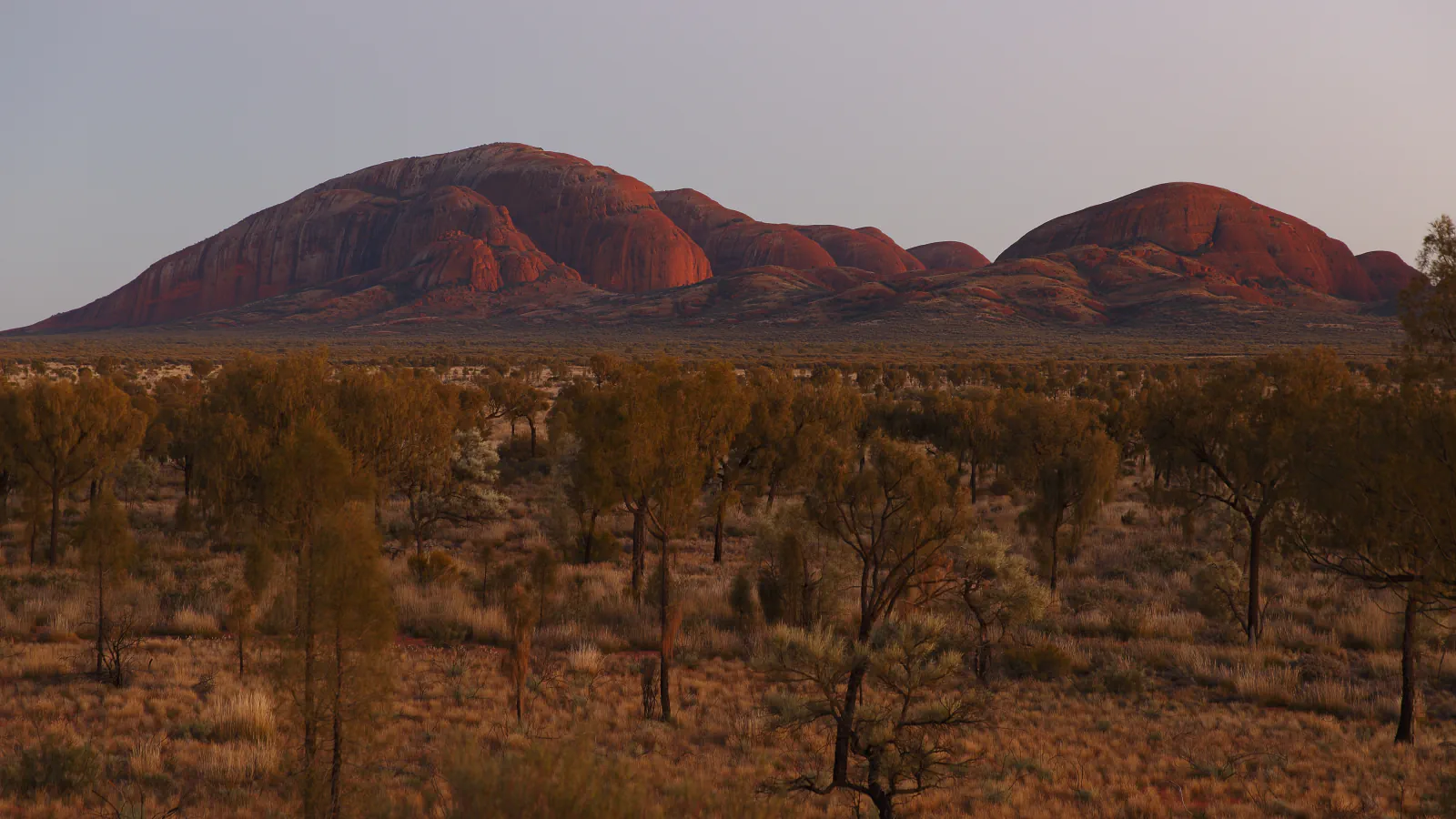
Uluru and Kata Tjuta stand in the Northern Territory, in central Australia. UNESCO names the Anangu as the traditional owners and explains that Pitjantjatjara and Yankunytjatjara people use that word for themselves. On 26 October 1985 the Governor-General handed the park’s title deeds to Anangu at a ceremony in the Mutitjulu community, and Anangu leased the land for 99 years to the Australian National Parks and Wildlife Service, now Parks Australia. A board of management was set up that December with a majority of Anangu members. Today it has 12 members, eight of them Aboriginal people nominated by Traditional Owners, and Parks Australia carries out its decisions. Parks Australia writes the names with diacritics (Uluṟu, Kata Tjuṯa, Aṉangu) and says that Tjukurpa, Anangu law, guides everything that happens in the park.[1][2][3]
The Great Barrier Reef Marine Park, from a lime-mining lease to an Act
The Great Barrier Reef lies off the coast of Queensland. In 1967 an application was made for a lease to mine coral for agricultural lime on Ellison Reef, off Mission Beach in North Queensland. Conservation societies, seeing it as a test case, opposed it in the Innisfail Mining Warden’s Court, and in December 1967 the Warden rejected the application. They then campaigned for the Australian Government to declare a marine park. The Great Barrier Reef Marine Park Act 1975 received Royal Assent on 20 June 1975 and set up the Great Barrier Reef Marine Park Authority to manage the park with the Queensland Government. The park was declared in sections, and the first was the Capricornia Section in central Queensland, 12,000 km², in 1979. The Zoning Plan that came into operation on 1 July 2004 raised the no-take share of the park from 5 to 33 per cent.[4][6][5]
Hamelin Pool in Shark Bay: why the water is so salty
Shark Bay lies on the Indian Ocean coast of Western Australia, and Hamelin Pool is part of its World Heritage area. The state parks agency, the Department of Biodiversity, Conservation and Attractions, says the water in the pool is twice as salty as usual sea water because of a bar across the entrance of the bay. UNESCO attributes the hypersaline marine waters of Shark Bay, almost twice as salty as sea water, to the Faure Sill and to high evaporation. Stromatolites grow in Hamelin Pool: hard, dome-shaped structures formed by microbial mats, which UNESCO says developed in its hypersaline conditions. The reserve’s page names the Malgana people as Traditional Owners of the reserve and adds a local detail: cockle shells in the pool compressed into a solid mass that was cut into blocks for some of Shark Bay’s historic buildings.[7][8]
Good to know
A few clear answers before you explore.
Who runs Uluru–Kata Tjuta National Park today?
Anangu and Parks Australia manage it jointly. A 12-member board of management makes the major decisions, and eight of its members are Aboriginal people nominated by Traditional Owners. Parks Australia carries out the board’s decisions and handles day-to-day management.[3]
How did the Great Barrier Reef become a marine park?
After the Ellison Reef mining application was rejected in December 1967, conservation societies campaigned for a marine park. The Act followed in 1975, and the first section of the park, Capricornia, was declared in 1979.[4][6]
Why is the water at Hamelin Pool so salty?
The state parks agency says the water is twice as salty as usual sea water because of a bar across the entrance of the bay, and that stromatolites grow there undisturbed as a result. UNESCO attributes the hypersaline waters of Shark Bay to the Faure Sill and high evaporation, and says the hypersaline conditions of Hamelin Pool led to the stromatolites.[7][8]
The WorldStamped community
Every visit becomes part of a story.
- Members with public visits
- 0
- Places with public visits or memories
- 0
- Public memories
- 0
No public visits have been counted here yet. Add this destination to your own map and choose what you want to share.
Members are counted once. Counts include only eligible public activity from profiles that allow search discovery. Private and followers-only content is excluded.